The Garmin GPSMAP 64sx is without a doubt one of the best hiking GPS devices out there. I've used it on numerous hikes and was very impressed with its overall durability, Bluetooth connectivity and its diverse range of routable roads and trails, making it ideal for all outdoor activities.
The Garmin eTrex 20x is rated highly for good reason. With enhanced memory and resolution and a durable water-resistance design, it can be put to excellent use in all kinds of beastly weather conditions.
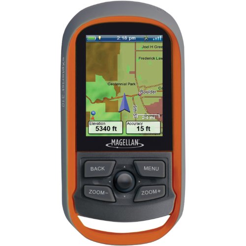
If you're looking for a GPS that's affordable, easy to use and has an outstanding sunlight-readable color screen, then the Magellan eXplorist 310 is perfect for hiking on a budget.
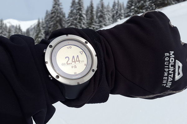
If you would prefer to look at other multi-functional devices with GPS capabilities, then check out our Best Watches for Hiking review, or our review on the Suunto Traverse hiking watch.
Best Hiking GPS (Top Picks)
Best Overall

Check Latest Prices
Editor's Choice

Check Latest Prices
Best Value
Check Latest Prices
This article contains affiliate links. If you buy something through the links on this page, we might get a small commission. It will not affect your price but helps keep our site alive!
Top GPS For Hiking
We reviewed over 11 hiking GPS for this article. Below are the best hiking GPS that made our short list.
- Garmin GPSMAP 64sx - Best Overall
- Garmin eTrex 20x- Editor's Choice
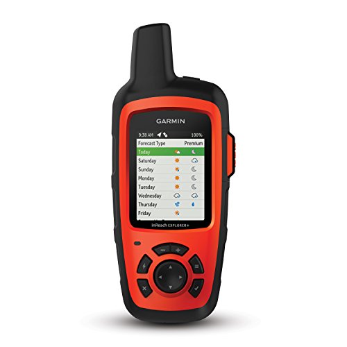
- DeLorme InReach Explorer
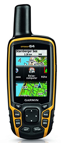
- Garmin GPSMAP 64
- Magellan eXplorist 310 - Best Value
Read our complete buyers guide for hiking GPS.
Best Overall Hiking GPS
1. Garmin GPSMAP 64sx
The Garmin GPSMAP 64sx is similar to the GPSMAP 64 model but has a few extra features, such as the ability to pair with your smart phone. This model also includes an altimeter, barometer and electric compass, which are all very useful features to have.
The Garmin 64sx has a 2.6" sunlight-readable color screen, features a quad helix antenna, and uses both GPS and GLONASS, which results in fast reception and excellent accuracy.
It's the perfect handheld GPS for hiking in thick forest or mountainous areas as it offers great coverage. With large buttons, the Garmin 64sx is ideal for cold weather situations where a touchscreen would be ineffective.
It even has a button specifically for marking waypoints which is very effective and efficient. You can pair the GPS unit with your smart phone to receive notifications, as well as share waypoints and trips. It has a battery life of about 16 hours and comes with a 32GB memory card where you can keep different routes and waypoints.
The GPSMAP 64st also comes with TOPO U.S. 100K maps for you to explore.
Main Features
What we like
What we dislike
Key Takeaway
While the Garmin GPSMAP 64sx is a bulkier model, it is also one of the most reliable and easy to use. So if you're looking for a GPS device with all the basic essentials and some extra features, it is an excellent choice.
2. Garmin eTrex 20x
4.5/5 Overall Rating
Read Full Review
The Garmin eTrex 20x offers all the basic features you need in a GPS device at an affordable price. It has a 2.2" sunlight readable screen with great resolution so that it's always clear to read and easy to see.
With an internal memory of 3.7 GB and a MicroSD card slot, you can store many different maps on this device. It also includes a preloaded base map with relief shading. The eTrex 20x can store and display important information such as locations, difficulty, terrain, and descriptions.
The eTrex 20x has both GPS and GLONASS receivers which makes finding your location much quicker and more accurate. It can hold up to 200 routes and 2000 waypoints at a time.
The eTrex 20x also includes BaseCamp software, which allows you to organize your maps, mark waypoints and plan your routes. You can even share your adventures with friends and family.
The eTrex 20x has multiple compatible mounts that can be used on different types of vehicles. With a super lightweight, compact and durable design, the Garmin eTrex 20x can fit easily into one of your pockets and barely adds any weight. Its battery can last up to 25 hours and the device itself is tough and water resistant.
It has a very user-friendly interface with buttons that are easily pushed even when wearing thick gloves. The Garmin eTrex 20x may not have many of the extra features that more expensive devices have, but it will serve you well and its performance will remain constant, no matter what sort of terrain or weather you find yourself in.
Main Features
What we like
What we dislike
Key Takeaway
The Garmin eTrex 20x is a simple, yet reliable handheld GPS that incorporates all the essential features that you need. It works efficiently and accurately and is great value for what you get.
3. Garmin InReach Explorer
4.5/5 Overall Rating
Read Full Review
The InReach Explorer is not only a GPS navigational device, but also a satellite communicator. This means that you can send and receive emails or short text messages from cellphone numbers and keep in touch with your friends and family while you're out exploring the wilderness.
The InReach Explorer is a great GPS device to consider if you travel frequently to places with no cell signal, as it allows you to update your loved ones on where you are and how you're doing. It also features an SOS emergency function that will show you that your alert was received so that you know help is on the way.
The GPS and navigational features of the InReach Explorer are very impressive, as it will help you to plan multiple routes, create waypoints, log the details of your trip, and help you find your way back to the start with a breadcrumbs trail.
You can set a tracking feature to transmit your location details in regular intervals that range from 10 minutes to 4 hours. The InReach Explorer gives you access to the Earthmate app, which allows you to download free topographical maps onto your smartphone or compatible tablet.
Pairing the InReach Explorer with a device opens up many useful additional features and lets you view maps on a bigger screen. You can check your trip distances and speed, moving average, and other interesting stats.
The DeLorme InReach Explorer also features an altimeter, barometer, and compass, which are extremely useful features for hiking.
Main Features
What we like
What we dislike
Key Takeaway
The InReach Explorer is a multifunctional handheld GPS device that will not only help you to navigate your way, but also keep in touch with your friends and family. It's a great choice if you frequently travel to remote places with limited cellphone signal.
4. Garmin GPSMAP 64
4/5 Overall Rating
Read Full Review
The Garmin GPSMAP 64 is a durable and reliable handheld GPS device. It has a 2.6" colour display which is readable in all types of sunlight. It has a water resistant, rugged design so that you don't have to worry about it malfunctioning if you get caught in some rain.
With its high sensitivity GPS and GLONASS receiver combined with a quad helix antenna, the Garmin 64 has excellent reception and will find your position quickly and accurately.
With an integrated worldwide base map that shows shaded relief, the Garmin GPSMAP 64 helps you navigate your way with ease. Photo navigation allows you to find places from downloaded pictures that have been geo-tagged. BirdsEye Satellite Imagery (subscription required) software is supported, which allows you to integrate satellite images with your maps.
The Garmin GPSMAP 64 is also compatible with Custom Maps, which lets you convert paper maps into digital, downloadable maps. This eliminates the need for paper maps, which is more environmentally friendly.
The Garmin GPSMAP 64 can use either 2 AA batteries or a rechargeable NiMH battery pack, which can be charged when inside the handset. With 4GB internal memory, as well as a MicroSD slot, you have plenty of space to download maps and satellite images. The battery life for the GPSMAP 64 is roughly 16 hours.
Main Features
What we like
What we dislike
Key Takeaway
The Garmin GPSMAP 64 is a good and reliable handheld GPS that offers all the necessary features to help you navigate your way through any type of terrain.
5. Magellan eXplorist 310
The Magellan eXplorist 310 is a great entry level handheld GPS device. It offers basic navigational features and has a IPX-7 waterproof design, which makes it ideal for rugged, outdoor adventures.
While the technology it uses isn't has effective as other GPS devices, the eXplorist 310 can help you navigate through remote terrain, even though it may have a little lag time. It features a 2.2 inch LCD colour screen, which has good readability in all levels of light and offers a power saving mode to extend its 18 hour battery life further.
The eXplorist 310 can track and record key details, such as your total distance travelled, ascent and descent , average speed as well as your average time. It will log all the steps you take so that you can easily find your way back to the starting point of your trip.
The eXplorist 310 comes with a good base map with a detailed road network, that shows different features such as bodies of water, rural/urban land, and shaded relief. It offers paperless geocaching, which allows you to download and look at over 20 distinct characteristics for each geocache.
The compass feature overlays the display screen, providing you with combined navigational functions to help you find your way. The Magellan eXplorist 310's menu is easy to navigate but can take a few clicks of a button to take you where you want to be.
Main Features
What we like
What we dislike
Key Takeaway
Overall, the Magellan eXplorist 310 is a good and sturdy handheld GPS. It performs all basic navigational functions that will help you create and plan your routes.
Hiking GPS - Buyer's Guide (Key Features)
Reception Quality
With today's technology, most modern GPS units are extremely accurate and reliable. GPS devices that use Wide Area Augmentation System (WAAS) are typically accurate to 3 meters. Ones that use GLONASS satellites lock on to your position roughly 20% quicker.
Reception quality becomes poorer in obstructed areas. So if you're in thick forest, built-up urban areas or deep canyons, expect some lag time in finding your location.
Preloaded Maps and Mapping Software
GPS devices typically come with a very basic base map, but some may also include some topo maps. Most GPS devices have software that makes downloading maps from different applications very simple and easy to do. While some apps or software may require a subscription, there are many free ones that you can use.
You should also have a look at what mapping functions a GPS device can perform. Things like creating routes, marking waypoints, tracking, organizing data and displaying key information are quite important and useful features to have.
Memory
A GPS device's internal memory determines how many different maps, waypoints and data files you can store on your device. Many GPS devices also feature a MicroSD card slot which you can use to increase you storage space.
Compatibility with Devices
Sometimes GPS devices will have the ability to sync with your smart phone or tablet to help share you trips and statistics, as well as view your data and other key information picked up on your trip.
Some devices can even receive notifications from your smart phone so you can keep up to date with your friends and family.
Several GPS manufacturers have their own apps that work well with their devices and offer many useful features. While this isn't a necessary feature in a GPS device, it is nice to have and can be very useful in keeping track of your trips and personal stats.
Battery Life
Battery life is another key feature to look at when making your decision. You'll need a device to last the duration of your trip so that you can always find your way when you're in unfamiliar terrain.
Some devices use regular AA batteries so you pack extra with you on your trip, while other have rechargeable batteries that you should charge in advance or find a solar charger to take with you and never worry about running out of charge.
Touchscreen vs Buttons
While touchscreens carry out commands quicker, they also use up more battery power. Buttons are more useful in colder weather conditions as they function even when you have thick gloves on, whereas touchscreens won't register the touch very well.
Both builds have pros and cons so it's really up to your own personal preference. Buttons are more reliable, but slower. Touchscreens offer faster response times, but will drain the battery quicker.
Continue browsing
See more reviews of outdoor equipment and our detailed hiking technology guide. Or check out these reviews:
