The Virginia section of the Appalachian Trail is by far the longest, at 554 miles to hike the entire state. This is a significant part of one of the best long hikes in the world.
Read more to find a comprehensive guide on getting through this section of the AT.
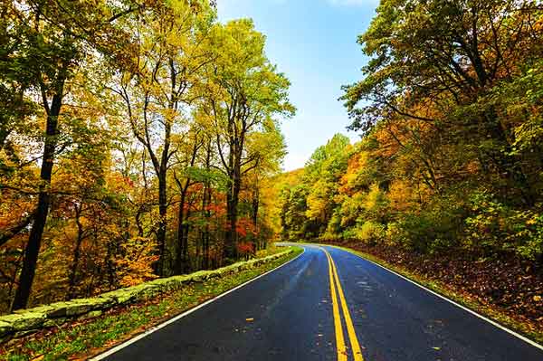
Route Overview Of The AT In Virginia
The landscape of Virginia could be described as rolling hills rather than the steep mountains in other states.
There are quite a few points of interest in Virginia from the ponies in Grayson Highlands, the black bears in Shenandoah National Park, and the craggy rocks at Tinker Cliffs and Dragon’s Tooth.
Here are some additional hikes in Virginia.
Getting To The Trail
The Virginia section of trail begins in Damascus, Virginia and ends in Harpers Ferry, West Virginia. There isn’t a convenient way to take public transportation between the two towns.
You could potentially leave your car in the town of Harpers Ferry and take a train into Washington D.C. From there you can take a Greyhound bus to the town of Marion, Virginia. It’s still another 30 miles from Marion to Damascus, so you will need to either hitch-hike or take a taxi.

Benefits & Challenges of Hiking AT in Virginia
Benefits Of Hiking AT In Virginia
The famous town of Damascus, Virginia annually hosts Trail Days, the world’s largest hiking festival. Hikers come from all along the trail and past hikers come from all over the world to attend this weekend-long event.
The points of interest in Virginia are endless: there’s Shenandoah National Park, McAfee Knob (said to be the most photographs spot on the AT), Grayson Highlands, Tinker Cliffs, and Dragon’s Tooth.
The hills in this section are rolling and mellow. That’s not to say they are not difficult at times; it’s just not as challenging as more mountainous sections in other US states.
The Shenandoah provides the opportunity to spot black bears, which are extremely common in the park. Spend enough time hiking in this area, and you will almost certainly have an encounter.
With an abundance of trail towns and fairly mild hiking terrain, Virginia would be a good section for beginner hikers. However, there is enough scenery and points of interest that experienced hikers will enjoy as well.
Challenges Of The Virginia AT Hike
This is the longest state on the Appalachian Trail, and it can be incredibly mentally challenging to hike all of it.
Hikers will often say that they have “the Virginia blues”, meaning that they are tired of hiking the section.
Typical Virginia AT Itinerary
Day 1: Damascus to Saunders Shelter (8.3 miles)
Day 2: Saunders Shelter to Whitetop Mountain Road (11.9 miles)
Day 3: Whitetop Mountain Road to Old Orchard Shelter (17.7 miles)
Day 4: Old Orchard Shelter to Trimpi Shelter (14.1 miles)
Day 5: Trimpi Shelter to Chatfield Shelter (17.7 miles)
Day 6: Chatfield Shelter to O’Lystery campsite (16.3 miles)
Day 7: O’Lystery campsite to Chestnut Knob Shelter (11.2 miles)
Day 8: Chestnut Knob Shelter to Laurel Creek (14.8 miles)
Day 9: Laurel Creek to Helveys Mill Shelter (9.2 miles)
Day 10: Helveys Mill Shelter to Dismal Falls Trail (18 miles)
Day 11: Dismal Falls Trail to Sugar Run Gap (14.4 miles)
Day 12: Sugar Run Gap to Rice Field Shelter (17.2 miles)
Day 13: Rice Field Shelter to The Captain’s Place (13.7 miles)
Day 14: The Captain’s to Laurel Creek Shelter (17.3 miles)
Day 15: Laurel Creek Shelter to Niday Shelter (12.4 miles)
Day 16: Niday Shelter to Newport Road (16.8 miles)
Day 17: Newport Road to Lamberts Meadow Shelter (16.3 miles)
Day 18: Lamberts Meadow Shelter to Fullhardt Knob Shelter (14.4 miles)
Day 19: Fullhardt Knob Shelter to Cove Mountain Shelter (20 miles)
Day 20: Cove Mountain Shelter to Thunder Hill Shelter (17.2 miles)
Day 21: Thunder Hill Shelter to Glasgow (14.6 miles)
Day 22: Glasgow to Reservoir Road (15.4 miles)
Day 23: Reservoir Road to Piney River north fork (18.5 miles)
Day 24: Piney River north fork to Harpers Creek Shelter (16.1 miles)
Day 25: Harpers Creek Shelter to Paul C. Wolfe Shelter (22 miles)
Day 26: Paul C. Wolfe Shelter to Waynesboro (5.2 miles)
Day 27: Waynesboro to Blackrock Hut (19.8 miles)
Day 28: Blackrock Hut to Pinefield Hut (13 miles)
Day 29: Pinefield Hut to former South River Shelter (14.2 miles)
Day 30: Former South River Shelter to Rockspring Hut (17.9 miles)
Day 31: Rockspring Hut to Pass Mountain Hut (15.3 miles)
Day 32: Pass Mountain Hut to Gravel Springs Hut (13.1 miles)
Day 33: Gravel Springs Hut to Front Royal Hostel (9.6 miles)
Day 34: Front Royal Hostel to Manassas Gap Shelter (14.5 miles)
Day 35: Manassas Gap Shelter to Morgan Mill Stream campsite (16.2 miles)
Day 36: Morgan Mill Stream Campsite to Blackburn A.T. Center (14.5 miles)
Day 37: Blackburn A.T. Center to Harpers Ferry, West Virginia (12.5 miles)
Important Logistical Details

Guides & Accommodation
Guides: The vast majority of hikers do not hire guides for the Appalachian Trail. You can find trekking agencies who will take you if you want a guide. However, the trail is easy to follow and there’s ample resources available. With proper planning and preparing, even new hikers can give it a try alone.
Accommodation: Motels and hostels can be found in the towns and locations of Damascus, Marion, Atkins, Pearisburg, Newport Road, Troutville, Buchanan, Buena Vista, Lexington, Waynesboro, Swiftrun Gap, Big Meadows, Luray, Front Royal, and
Best Time To Go & Difficulty
Best Time: Spring, autumn, and early or late summer are all good times to hike in Virginia. You can hike during mid-summer if you like, but it will be very hot and humid.
Difficulty: Although the trek is 554 miles, this is a moderate section of trail. It’s not flat, but it’s not as steep as other sections of trail. The elevation changes are not drastic. There’s plenty of opportunities to get off of the trail and resupply.
Cost & Permits
Permits: A permit is required for the Shenandoah National Park section. It is free and hikers self-register at the park entrance.
Cost of Hiking AT in Virginia: This will entirely depend upon how frequently you visit towns and stay in motels. If you just go into town to resupply and only occasionally stay in motels, you could get by on $100 a week. If you like to stay in motels often, eat at restaurants, and buy expensive food at grocery stores; you could easily spend a few hundred dollars a week.

Pro Tip
Get your gear in the pack and go for a short hike with it prior to getting to Virginia. Ensure that you have it as light as possible, ideally under 10kg.
See our Appalachian trekking gear list here it should help you select only the must-have items!
Training For The Trek
The best way to learn how far the AT trek in Virginia USA is going to test your physical ability, is to go on some day-long hikes in your own country.
This will also allow you to break in your hiking shoes and increase your fitness level. For your exercise routine, we recommend building a combination of hiking, cycling, swimming or rowing to get your heart rate up three times a week.
For aerobic exercise, it is important that you build endurance rather than run at a high intensity so for example if you are planning on jogging, running 5km-10km about 3 times a week at a consistent pace should be the intensity that you are aiming for.
Recommended Guidebook

The Appalachian Trail Conservancy and the Appalachian Long Distance Hikers Association work together every year to create the most up-to-date guide on the Appalachian Trail. It is called Appalachian Trail Thru-Hiker's Companion.
In 2019 they included 50 updated maps, professionally crafted elevation profiles, and comprehensive tables for more easy access to the information while trekking.
It works both for thru-hikers and those who only want to trek a section or two.

Browse more Appalachian hikes and guides
See our complete guide to the Appalachian trail, or visit our section guides.
