Predictably, many of the trails below feature sections of the extensive Appalachian Trail, which runs all the way from Georgia to Maine. While it is possible to stay on the trail almost indefinitely, we have chosen some of the key highlights for the best hiking trails in Virginia, USA.
Each of these trails shows off different aspects of Virginia’s vegetation and physiography, and provide interesting challenges to get your heart pumping.
Whether you are looking for a scenic afternoon stroll with your children, or a gruelling multi-day adventure, there is something for you here. As such, it is impossible to compare the following trails as they each offer something unique – the order in which they appear does not correspond to their “rankings”.
Read on for some inspiration in planning your next trip. We believe that there is no better way to see a new place, or get to know any country than by hiking through its backcountry.
The distances and durations given for the hikes below include the entire roundtrip, even for “there and back” trails.
For specific Appalachian Trail sections, see:
Hiking In Virginia – Best Trails
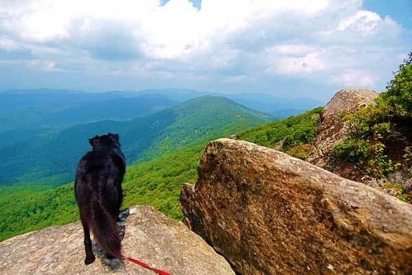
Mary’s Rock
Trailhead: Meadow Spring parking lot
Distance: 4.5 km
Elevation gain: 304 m
Duration: ~3 hours
Difficulty: Easy
The hike to Mary’s Rock can be completed starting from several trailheads, including the Panorama parking area (5.9 km), Jewell Hollow Overlook (9.6 km) and Buck Hollow parking area (14.5 km).
The details given above are for the shortest route, which starts from the Meadow Spring parking lot. The trail is well defined, and most of the modest elevation gain occurs in the first section of the hike.
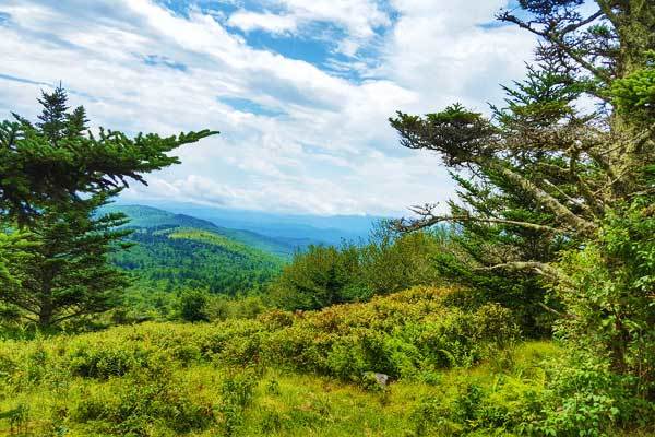
Look forward to two viewpoints which boast incredible vistas of the Shenandoah National Park and a fun rocky outcrop, ideal for sunset drinks and snacks.
We recommend that you plan to do the hike during the fall, when the forest colours are unbeatable. Otherwise, a springtime visit offers a sprinkling of wildflowers along the trail to add some colour.
Bearfence Mountain
Trailhead: Bearfence Mountain parking lot
Distance: 1.9 km
Elevation gain: 115 m
Duration: 1-2 hours
Difficulty: Easy
The trek up Bearfence Mountain is a quick loop which leads past two rocky outcrops, perfect for looking over the rolling hills of the Shenandoah National Park.
Adventurous hikers enjoy the final rock scramble as you reach the summit, which is interactive, fun, and intimidates the crowds away. This scramble is difficult for dogs, and so this trail is one of the few in the park that disallows pets.
At the top, there are panoramic vistas of the Blue Ridge Mountains where you can watch as summer storms thunder in the distance, as the leaves are set ablaze in the fall and as they gently resurrect again in springtime.
Although the trail is usually not too crowded, if you are planning your trip for the weekend, it is best to arrive early.
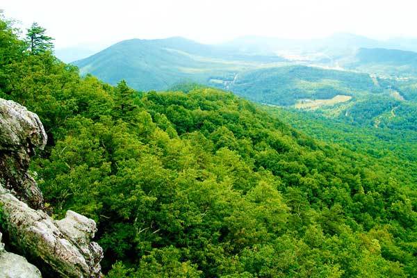
Blackrock Summit
Trailhead: Brown Gap, near mile marker 83 on Skyline Drive Skyline Drive
Distance: 8.2 km
Elevation gain: 193 m
Duration: 2-3 hours
Difficulty: Easy
Typically, the hike to Blackrock Summit is under a kilometre long, but if you are making the drive to the South District of Shenandoah National Park, you might as well extend the walk and explore some of the beautiful Appalachian Trail.
Blackrock itself boasts one of the most expansive views of the park, and walking south on the AT from Brown Gap adds some time in the verdant forest and a more gradual warm-up.
By the time the rest of the hikers have joined you from the Blackrock Parking area, the climb steepens and eventually turns into a giant pile of boulders at the summit.
It might take some time to scramble up these rocks to the ultimate peak, and even if you skip this extra exertion the views are spectacular. Once you’ve soaked it all in, head back to your car on the same route.
Cole Mountain
Trailhead: George Washington National Forest’s Pedlar Ranger District
Distance: 9.3 km
Elevation gain: 762 m
Duration: 3-4 hours
Difficulty: Easy to Moderate
The Cole Mountain (or “Cold Mountain”) Loop of Amherst County is one of the only hikes in Central Virginia which features a bald, or pasture-like summit. This open meadow feels expansive, offering lovely views of the surrounding landscape and a variety of options for picnic spots.
One of the highlights of the hike is the diverse scenery that you will encounter along the way – from lush ferns and pine forests to meadows of wildflowers, you will feel like you’ve had a taste of it all.
After an idyllic picnic, continue along the ridge-like meadow, re-enter the treeline and follow the Appalachian Trail back to your car. If you are looking for greater challenge, the hike can be combined with Mount Pleasant, which is of similar difficulty and also offers fantastic views.
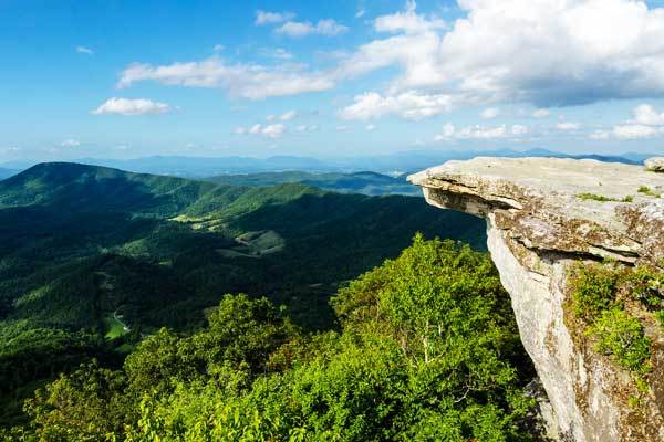
McAfee Knob
Trailhead: VA311 parking area
Distance: 13.3 km
Elevation gain: 530 m
Duration: 4-5 hours (including a lunch break)
Difficulty: Moderate
The McAfee Knob is the most photographed spot on the Appalachian Trail, and is one of the most popular hiking destinations in Virginia.
Standing on the famed protrusion that seems to hang off the edge of the world is an epic feeling, and gives you a 270-degree view of the Catawba Valley, Roanoke Valley and the Blue Ridges. It goes without saying that you should be careful of the significant drop-offs.
Because of the inevitable crowds, many of whom overnight on the trail, it is best to do this trail during weekdays and early in the morning. Follow the well-marked trail, over the occasional wooden walkways through sparsely dotted trees and shrubbery.
Once you’ve been hiking for some time, make sure that you look out for the relatively innocuous “Overlook” signpost, so as not to miss the viewpoint turnoff.
Dragon’s Tooth
Distance: 7.4 km
Elevation gain: 370 m
Duration: 2-3 hours
Difficulty: Moderate
Dragon’s Tooth requires a notoriously precarious scramble, and contains what is sometimes called “the toughest mile of the AT South of Mahoosuc Notch”.
The climb includes slippery slabs, narrow ledges and entails the use of intimidating iron rungs nailed into rock-surfaces to help with some of the traverse.
There are roots, boulders and even a dramatic (if diminutive) cliff face that need to be negotiated, so this is as much an interactive experience as any hike.
The “Tooth” itself is a slab of quartzite that protrudes from a clearing – although the views from the clearing are pleasant, the real splendour of the landscape can only be appreciated if you push your vertigo one step further and climb up the rock formation.
This hike can get really busy, so schedule it for the early morning and preferably during the week.
Hazel Falls and Cave
Trailhead: Meadow Spring, 2 mi. South of Thornton Gap Entrance Station
Distance: 8.4 km
Elevation gain: 243 m
Duration: 3-4 hours
Difficulty: Easy to Moderate
The hike to Hazel Falls is an easy, pleasant meander through a lovely forest, with wildflowers spattering the scenery along the way.
You will then arrive at a beautiful and underrated natural wonder – although the falls are relatively small, their heavy flow and the intimate adjacent caves arguably make the experience just as impressive as its more famous Virginian rivals, such as Dark Hollow and White Oak Canyon.
If you’d like to extend the hike, consider adding 5.6 km by taking the White-Rocks-Hazel River Trail loop, which takes you past several worthwhile viewpoints and a few more demanding climbs.
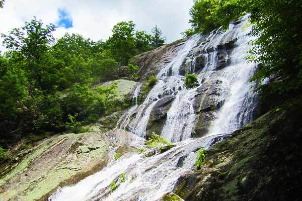
Crabtree Falls
Trailhead: Upper parking lot in the Crabtree Falls area
Distance: 5.1 km
Elevation gain: 305 m
Duration: 1-2 hours
Difficulty: Easy to Moderate
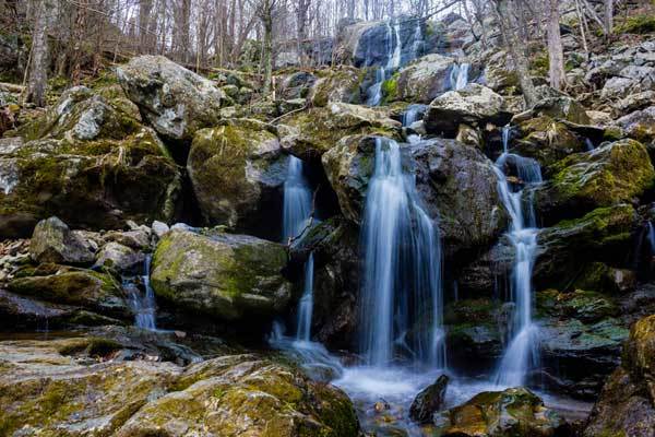
Crabtree Falls is one of Virginia’s most famous waterfall hikes, and for good reason. Boasting over 350m of cascading falls, the iconic water feature is seriously spectacular.
If you can arrive there early in the morning, you have a greater chance of catching the falls plummeting into atmospheric fog, as well as the blooming of the mountain laurel.
Even if you don’t time your hike during the morning mist, the falls will be gorgeous. As you start the trek, you will notice an informative signpost in the parking area, cautioning hikers to keep off the waterfall.
The rocks are coated with incredibly slippery transparent algae and a number of unfortunate hikers have lost their lives trying to negotiate the terrain. The trail itself consists of railings, paving, steps and wooden walkways arranged in switchbacks to make the gradient more manageable.
There are still some rocky and muddy sections, but it is all easily traversable. Throughout the walk, you will be able to hear the pleasant gushing of the falls.
Damascus to Marion (AT)
Trailhead: Damascus, VA
Distance: 109 km
Elevation gain: 4491 m
Duration: 5-7 days
Difficulty: Strenuous
The Damascus to Marion section of the AT is a highlight for many of the committed thru-hikers (those who trek the entire trail), but can also be done in isolation. The route passes through the Grayson Highlands State Park, which is inhabited by herds of wild ponies, an exciting distraction from the many miles ahead of you.
This section of the hike entails rock scrambling, root manoeuvring, but it does take you past some sweeping views of the park and a diverse range of scenery. The forested areas through which you will trek are seriously beautiful. They are lush and have the ethereal feeling of a fairy’s wonderland with the thin, ebony tree trunks piercing carpets of ivy and fern, all softly blanketed by a gentle mist.
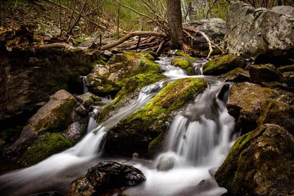
Dark Hollow Falls and Rose River Falls
Trailhead: Fisher’s Gap Overlook parking area
Distance: 6.4 km
Elevation gain: 290 m
Duration: 1-2 hours
Difficulty: Easy
The loop from Dark Hollow Falls to the Rose River Falls can be started at either of the falls’ trailheads, but we recommend starting at the Fisher’s Gap which is much less crowded and makes for more convenient photo opportunities along the 3 km of cascading waterfalls.
Start the hike by heading down into the valley where you will reach the first streams. Continue on and you’ll find the Rose River Falls which you can observe from the trail or scramble down to its base and get a worm’s eye perspective.
Afterwards, follow along the stream, and perhaps pick a tranquil spot to set up your rod for an hour’s meditative trout-fishing. Check out the Dark Hollow Falls before heading back to the parking lot.
East and West Dike Loop
Trailhead: False Cape State Park
Distance: 10.7 km
Duration: 2-3 hours
Difficulty: Easy
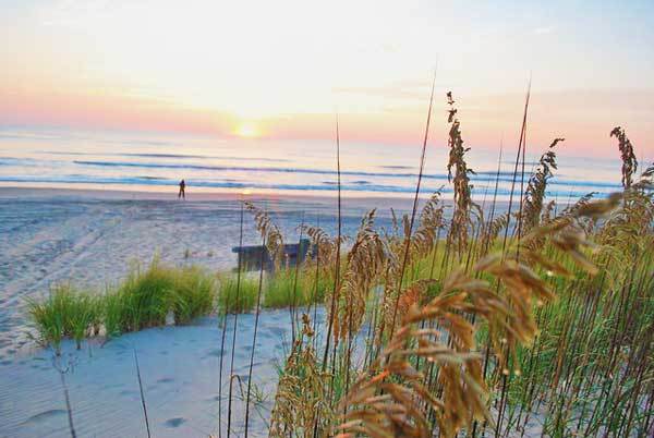
The East and West Dike Loop is a great way to visit the False Cape State Park and gain access to Virginia Beach without hordes of tourists to mar the experience.
The Bay also has somewhat of an eerie historical significance: hundreds of years ago, sailors frequently mistook the region for Cape Henry, causing numerous shallow-water shipwrecks and a community of castaways who assembled on its shores.
The area was abandoned in the 1930s, but the spooky skeleton of shipwreck Cynthia is still visible from the beach during low tide. The area itself is home to various species of animals, such as feral pigs, egrets and occasionally even dolphins and beached seals.
Although the trails are not particularly interesting, and consist of a monotonous gravel road, it is lovely to have such secluded access to the park. Make sure you check the park’s official website before your visit, however, because the trails are often closed for wildlife conservation.
Want more amazing hikes in USA? Check out these…
