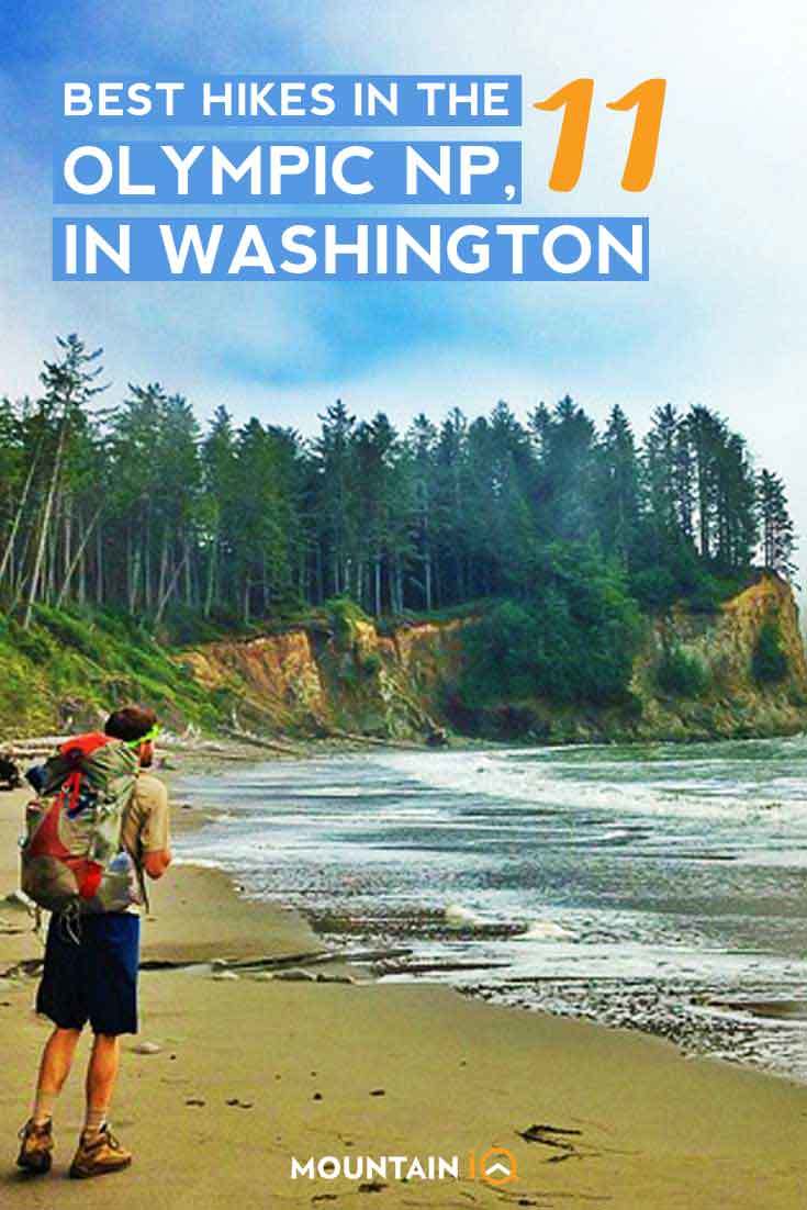
Olympic National Park is a vast and breathtaking wilderness area located in the Pacific Northwest region of the United States. It is known for its rugged coastline, lush temperate rainforests, and towering mountains.
The park boasts a vast network of hiking trails that offer visitors the opportunity to explore its diverse landscapes and experience its natural beauty up close.
Whether you’re a seasoned hiker or a novice, there is a hike for everyone in Olympic National Park. In this article, I explore the best hikes in Olympic National Park has to offer.
Best Olympic National Park Hikes
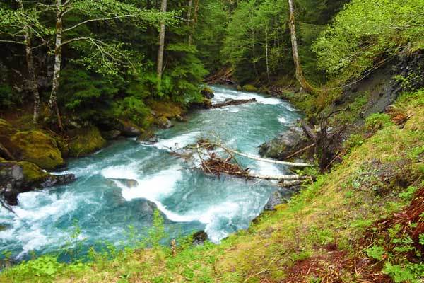
Hoh River Trail
- Trailhead Location: Hoh Rain Forest
- Distance: 49 km
- Elevation gain: 1558 m
- Duration: ~ 3 days
- Difficulty: Easy to Moderate
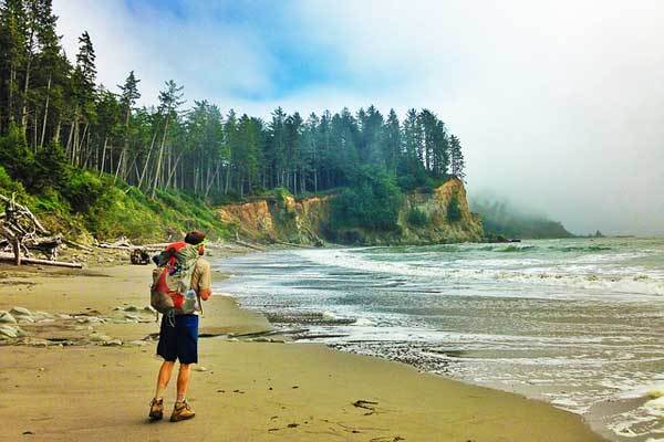
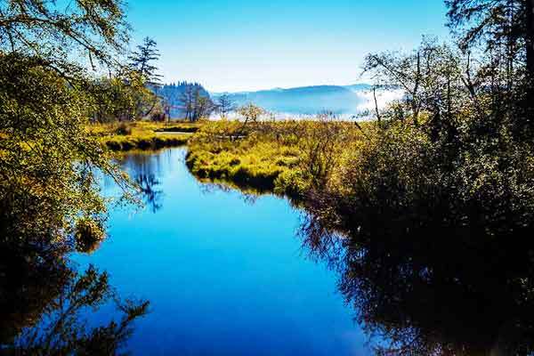
The Hoh River Trail is one of the National Park’s most popular regions. As a temperate rainforest, the Hoh Rain Forest receives over 12 feet of precipitation annually, mostly in the months between October and April.
This results in a plethora of lush vegetation, characterised by verdant ferns, moss, Giant Sitka spruce and western hemlocks. Through this landscape winds the Hoh River Trail, which starts off as a relatively flat meander along the northern banks of the Hoh River and eventually steepens significantly until you reach the glacial meadow at the base of Mount Olympus.
From here, you turn around and head back the way you came. The hike can be truncated and turned into a family-friendly day-hike, or you can use one of the multiple campsites along the route to allow enough time complete the full adventure.
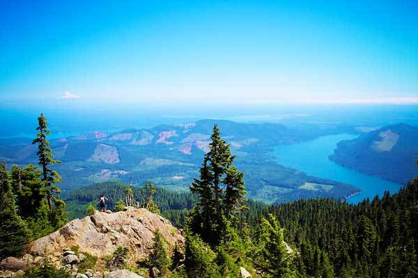
Hurricane Ridge
- Trailhead Location: Hurricane Ridge Visitor Centre
- Distance: 5.1 km
- Elevation gain: 240 m
- Duration: 1 – 2 hours
- Difficulty: Easy to Moderate
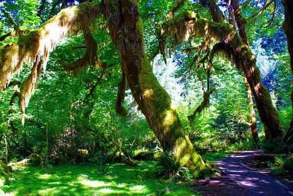
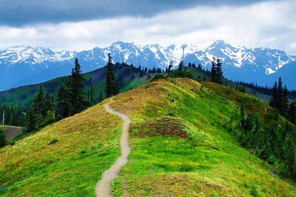
Hurricane Hill is a great introduction to the Olympic National Park, and can serve as the initial portion of a number of lengthier hikes, such as a 22-km round trip from the Elwha River Valley web of trails.
The path is generally snow-free between July and September; it is well maintained, easily accessed and is even paved for some of the trail. Right from the get-go, the walk offers sprawling views of the Strait of Juan de Fuca and the glacial peaks of the park.
The trail winds through pine forests, indigenous shrubbery and past helpful signboards which point out notable landmarks on the horizon. If you visit during summer, you will likely encounter marmots, deer and possibly mountain goats grazing on the adjacent ridges.
When you reach the top of Hurricane Hill, you will be treated with panoramic views of the Olympic Range, Vancouver Island and Puget Sound. Return to your car on the same trail.
Enchanted Valley via East Fork Quinault River
- Trailhead Location: Graves Creek Trailhead
- Distance: 41 km
- Elevation gain: 518 m
- Duration: 2 days
- Difficulty: Moderate
The Enchanted Valley chalet has provided shelter for weary travellers since the 1930s. During the Second World War, the chalet was converted into an Aircraft Warning Station and has consequently been listed on the National Register of Historic Places.
To reach this remarkable destination, you will walk through the ancient Douglas firs, western red cedars and Sitka spruce forest along the East Fork Quinault River trail.
The shaded trail which winds along with the river occasionally opens up to show the glorious snow-capped Olympic Mountain peaks.
Once you reach the chalet, you will gain access to a magnificent, panoramic view of the mountains lining the valley, whose cliff are streaked by sparkling waterfalls in the summertime.
Remember that this is bear territory, so make sure that all your provisions are properly stored in a bear canister for camping.
Mount Storm King
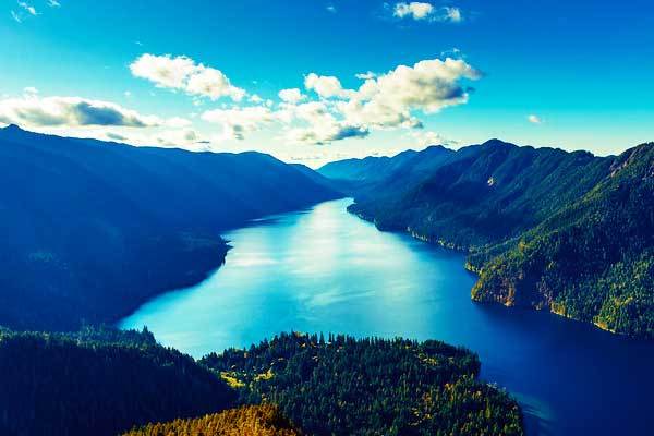
- Trailhead location: Lake Crescent
- Distance: 4.5 km
- Elevation gain: 519 m
- Duration: 3-5 hours
- Difficulty: Strenuous
The hike up Mount Storm King is one of the favourites of the peninsula, famous for its exquisite views of Lake Crescent as well as its extreme gradient.
The trail weaves through an old-growth forest, passing two lookouts on the way.
The first is basically a forest clearing, from which you can see across the lake and up to the distant Straits of Juan De Fuca. To reach the second lookout, you will have to use technical ropes to scramble and reach the summit of Mount Storm King.
If you’d like to extend the excursion, the option of the “grand traverse” is available. This more challenging route starts at Barnes Creek, heads up to Lookout Dome, after which it leads you to the summit Mount Storm King.
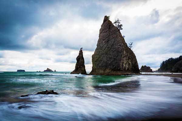
Rialto Beach
- Trailhead Location: Mora Road outside La Push
- Distance: 3.2 km
- Elevation gain: Negligible
- Duration: ~1 hour
- Difficulty: Easy
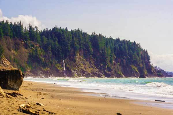
Rialto Beach is one of the most popular coastal walks within the national park, and is easily accessible by a quick walk from the beach access point.
Along the pebbled shore, you will see massive logs of driftwood, teaming tidal pools, sea stacks and squawking seabirds. Walk for as long as your legs will carry you, crossing Ellen Creek by balancing over a fallen log.
Although there is the option of staying overnight if you organise a permit, you can also mark the end of your walk and turn around once you’ve seen the epic Hole-in-the-Wall rock feature.
On the way back, go and take a look at the adjacent First Beach. Other similar walks that are great tide-pooling locations include Ruby Beach, Beach 4 (both near Kalaloch), Second Beach and Third Beach.
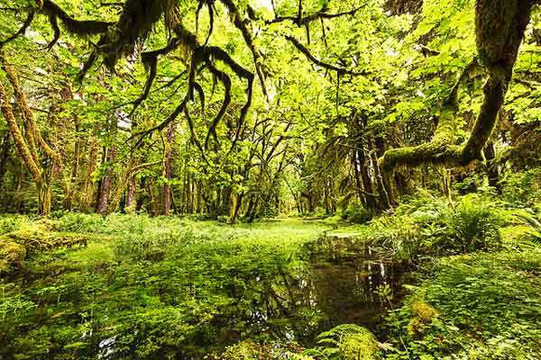
Quinault Rain Forest Nature Loop
- Trailhead Location: Quinault National Forest
- Distance: 0.8 km
- Elevation gain: 12 m
- Duration: ~ 10 minutes
- Difficulty: Easy
The Quinault Rain Forest Nature Loop is really more of a quick jaunt than a walk, but the staggering scenery it offers makes it one of our favourites.
Strictly speaking, the loop falls just outside of the Olympic National Park. However, the educational interpretive signs which inform visitors about the fragile temperate rainforest ecosystem is the perfect introduction to a longer hike within the Park’s boundaries, so we thought we’d include it on the list anyway.
Walk through the dripping, gargantuan trees, over carpets of velvety moss and listen to the joyful chirping of various insects and birds all the while reading about their delicate and vital interactions.
There is also a small waterfall that you can visit if you take a small detour down a side trail as you approach the parking lot.
Ozette Triangle (Cape Alava Loop) Trail
- Trailhead Location: Lake Ozette
- Distance: 14.8 km
- Elevation gain: 30 m
- Duration: ~2 days
- Difficulty: Easy
The Ozette Triangle Trail combines some of the best beach-side and forest trekking that you can find in the Olympic National Park. Start by walking along the shoreline of Lake Ozette, the largest, natural, unaltered lake in Washington.
After crossing the Ozette River on a rickety bridge, keep right on the trail junction to continue the loop. From here, the route is straight-forward. The trail is technically a triangle because it consists of three prominent, straight stretches: Cape Alava Trail, North Sand Point
Trail and the stretch of coastline which links the other two sides.
The canopy of the Cape Alava Trail consists of old-growth, giant Sitka spruce, western red cedar, and western hemlock, while the floors are carpeted with dense salal, devil’s club and bog skunk cabbage, all of which thrive in the heavy annual rainfall.
Furthermore, the area has an ancient history of human habitation, with evidence of human culture in the area dating over 2000 years ago. You have the option of completing the trek in one day, or extending it over two and camping along the way.
Klahhane Ridge Trail and Sunrise Point
- Trailhead Location: Hurricane Ridge Visitor Centre
- Distance: 9 km
- Elevation gain: 518 m
- Duration: ~3 hours
- Difficulty: Easy to Moderate
The Klahhane Ridge Trail begins with the High Ridge Trail which leads from the parking lot to a junction with Sunrise Point Trail – follow this short path to Sunrise Point for some epic views of the Strait of Juan de Fuca.
Otherwise, continue on the High Ridge Trail and continue onto the Klahhane Ridge Trail.
Meander through flowery meadows stocked with munching deer and on ridges spotted with marmots. You will gain access to southern views of the Olympic Peaks, as well as of the North Cascades.
Finally, you will reach Klahhane Ridge which cuts along the base of Mount Angeles at which point you can turn around and head back.
Third Beach to Strawberry Beach
- Trailhead Location: Third Beach trailhead
- Distance: 18.8 km
- Elevation gain: 99 m
- Duration: ~8 hours
- Difficulty: Easy to Moderate
The trail from Third Beach to Strawberry Beach is perfect for those wishing to extend the classic, quick beach stroll, such as the Rialto Beach trail.
This stretch of beach offers all the same attractions characteristic of a Washington beach trek, including sea stacks, tide pools, driftwood, eerie sea views and oceanic wildlife.
Warm up by walking through beautiful old-growth forest, down the ravine and out onto the Third Beach campsite. Although it is a popular option to set up camp on Third Beach, we advise that you continue on to Strawberry Beach.
From here, the shoreline trail requires a bit of scrambling, and leads you on intermittent detours up the bank, through the forest and back down to the beach.
Whether you are planning on overnighting, or want to complete the roundtrip in one day, it is important that you keep an eye on the tides. High tide forces you to spend more time walking on the banks than on the beach, and obscures the contents of the tidal pools.
Marymere Falls
- Trailhead Location: Lake Crescent, Strom King Ranger Station
- Distance: 2.9 km
- Elevation gain: 54 m
- Duration: ~ 1 hour
- Difficulty: Easy
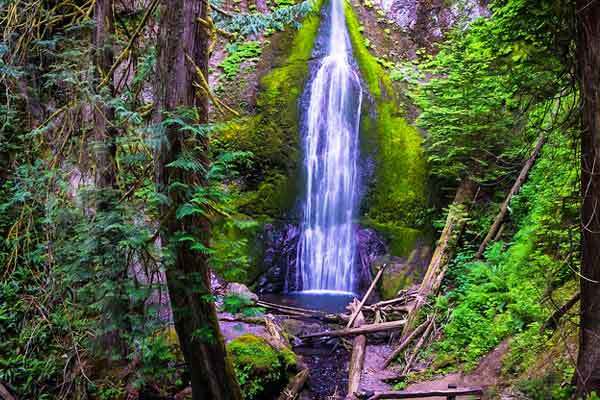
The Marymere Falls are easily accessed off Highway 101 via a short dirt path which winds through the classic old-growth forests of cedar, fir, alder and hemlocks.
As such, the landmark is popular and welcomes plenty of day visitors. Nevertheless, it is not to be missed. The water of the falls descends from a creek in Aurora Ridge, pouring down Marymere and continuing as Barnes Creek.
The trail to the falls crosses several bridges and rivulets, followed by a brisk uphill walk which is easily manageable for the whole family. Enjoy the gentle gurgling of the creek, the impressive view of the falls and the pleasant smell of dewy dampness that engulfs the area.
Mount Ellinor
- Distance: 10 km
- Elevation gain: 1005 m
- Duration: 4-5 hours
- Difficulty: Strenuous
Mount Ellinor is a strenuous day hike, with a steep elevation gain, which offers glorious panoramic views as a reward for those willing to make the effort. There are two routes to Mount Ellinor’s summit starting from the lower and upper trailheads.
The latter option eliminates the first 400 m of elevation gain, but it also removes the relatively gradual introduction to the climb – starting higher up means you’ll have to hit the ground running. Either way, look forward to sprawling vistas of Lake Cushman, the Cascades and the Hood Canal.
There is also the enticing (if slightly more dangerous) option of attempting the climb during winter, using ice picks and crampons for assistance.
A wintertime ascent means enjoyable glissading as the means of descent, a reward which may be even more tempting than the views from the peak.
Note that the mountain is inhabited by mountain goats, which, although charming from a safe distance, can become aggressive. Refrain from approaching the goats, and leave them to forage in peace.
Olympic National Park Hikes FAQ
What is the best time of year to hike Olympic National Park?
The best time of year to hike Olympic National Park depends on your hiking preferences and the specific trail you plan to hike. The park is open year-round, and each season offers its own unique experiences and challenges.
Summer (June-August) is the most popular time to hike in the park, as the weather is generally mild and the trails are more accessible. The park’s wildflowers are in bloom during this time, and the high country trails are free of snow. However, the park can be crowded during the summer months, and some trails may be busier than others.
Fall (September-November) is a quieter time to hike in the park, with cooler temperatures and fewer crowds. The fall foliage is also a stunning sight to see, with the park’s maple, alder, and cottonwood trees turning brilliant shades of orange, red, and yellow.
Winter (December-February) brings snow to the higher elevations, making some trails inaccessible without specialized equipment. However, the lower-elevation trails remain open, and winter hiking can offer a peaceful and serene experience. The park’s hot springs are also a popular attraction during the winter months.
Spring (March-May) is a time of renewal in the park, with the snow melting and the rivers running high. The park’s waterfalls are at their peak flow during this time, and the wildflowers begin to bloom in the lower elevations. However, the higher-elevation trails may still be snow-covered and inaccessible until late spring or early summer.
What is the most difficult hike in Olympic National Park?
One of the most difficult is the hike to the summit of Mount Olympus. This 17.4 mile (28 km) round-trip hike is a strenuous and technical climb that requires mountaineering skills, including the use of ropes and crampons. The trail gains over 7,900 feet (2,408 meters) of elevation and involves glacier travel, rock scrambling, and steep snowfields. The climb to the summit typically takes two to three days to complete, and it is recommended only for experienced and well-equipped climbers. Other challenging hikes in the park include the High Divide Trail, which traverses the ridgeline of the park’s mountain range, and the Enchanted Valley Trail, which follows a river valley and requires multiple creek crossings. These hikes also require a high level of physical fitness and hiking experience.
Is it safe to hike alone in Olympic National Park?
Hiking alone in Olympic National Park can be safe, but it is always recommended to hike with a partner or in a group for safety reasons. Solo hikers should take extra precautions to ensure their safety, including telling someone where they are going and when they plan to return, carrying a map and compass or GPS, and being prepared for changes in weather and trail conditions. It is also important to be aware of wildlife, such as bears and cougars, and to follow park guidelines for hiking in bear country.
Do I need a permit to hike in Olympic National Park?
It depends on the specific trail you plan to hike and whether you plan to camp overnight. Some trails in Olympic National Park require permits for overnight camping, while others do not. The park’s wilderness areas, which include many of the park’s backcountry trails, require a wilderness permit for overnight camping, and permits are limited to ensure the protection of the park’s natural resources. Day hiking in the park generally does not require a permit, but it is always a good idea to check with park rangers or the park’s website to confirm any permit requirements for the trail you plan to hike. Additionally, some popular trails may require a parking permit or fee to access the trailhead.
Are there bears in Olympic National Park?
Yes, there are bears in Olympic National Park. Both black bears and grizzly bears can be found in the park, although grizzly bears are rare and sightings are extremely uncommon.
Are there easy hikes in Olympic National Park?
Yes, there are many easy hikes in Olympic National Park that are suitable for hikers of all ages and abilities. Some examples of easy hikes in the park include the Hall of Mosses Trail in the Hoh Rain Forest, the Sol Duc Falls Trail, and the Spruce Railroad Trail along the shores of Lake Crescent. These hikes offer visitors a chance to enjoy the park’s stunning scenery without having to tackle challenging terrain or steep climbs.
More USA National Park Hikes:
- Best hikes in Yosemite
- Best hikes in Glacier National Park
- Best hikes in Grand Canyon
- Best hikes in Yellowstone
- Best hikes in Acadia
- Best hikes in Zion
- Best hikes in the Smokies
- Best hikes in Teton
- Best hikes in Bryce Canyon