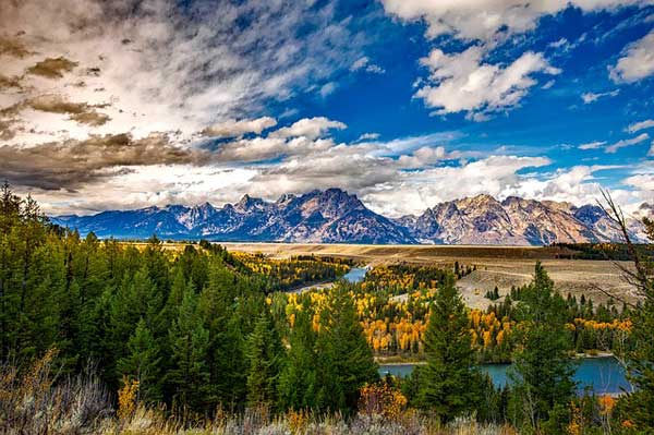
Grand Teton National Park is one of the most stunning areas in Wyoming, USA. Encompassing the major peaks of the Grand Teton mountain range, as well as pristine lakes, forests and phenomenal wildlife, the park is not one to be missed!
If you are looking for the Best Grand Teton hikes, I've put together my picks of the top five trails:
- Hidden Falls Trail
- Static Peak Divide
- Paintbrush Divide - Cascade Loop
- Taggart Lake - Bradley Lake loop
- Table Mountain Trail
Best Grand Teton Hikes
1. Hidden Falls Trail

Photo by Jacob Monninger
- Area: Jenny Lake Trailhead
- Permit: Not required for hiking but for staying overnight in the backcountry.
- Difficulty: Moderate
- Distance: 4.8 miles roundtrip
- Elevation: 450 ft. total climbing
- Time Hiking: 3 hours
- Best Time to Hike: May until October
This popular trail begins at the Jenny Lake Trailhead and then climbs the south shore to reach a view of 200 feet.
The loop is known as one of the most iconic trails in the park due to the spectacular views of the park's second largest lake, Jenny Lake, and the Hidden Falls itself, the park's beautiful 80-foot high waterfall.
Although there is some elevation gain, it is very gradual and the hike is relatively easy.
You can shorten the trip to one and a half hours by taking the shuttle boat across Jenny Lake. The shuttle makes the hike shorter and easy and adds an exciting element to the trip.
Accommodation
Jenny Lake Lodge and Jenny Lake Campground.
Hidden Falls Trail Pro Tips
- The eastern portion of the hike (closer to the lake) is closed through 2018 and therefore the trail cannot be completed as a loop.
- Keep an eye out for bears, as the huckleberry patches along the conifer forest section of the hike can attract them.
- The trail is one of the busiest in the park, so be aware of this when planning your day.
- Parking at Jenny Lake is limited in the summer months, either come earlier or later to try find parking.
- The use of personal audio devices is strongly discouraged.
2. Static Peak Divide

Photo by JpNyker
- Area: Death Canyon
- Permit: Not required for hiking but for staying overnight in the backcountry.
- Difficulty: Strenuous / Advanced
- Distance: 16.3 miles roundtrip
- Elevation: 5,000 ft. total climbing
- Hiking Time: 10 - 12 hours
- Best Time to Hike: June to August (Summer)
Begin your journey at the Death Canyon Trailhead. The hike starts in a whitebark pine forest and gradually climbs upwards until you reach Phelps Lake Overlook at the top of a ridge.
From the ridge you descend nearly to the lake, continuing west into Death Canyon. You will begin to ascend through the canyon until you reach the Patrol Cabin, near the top.
Here you turn right onto to the Static Peak Divide Trail. The trail becomes steep switchbacks that climb the western slopes of Albright Peak. Finally you will reach a saddle between Albright Peak and Static Peak.
From the saddle you will follow a trail up a ridge towards the Divide, with the remaining route to Static Peak towering above. After just over 8 miles of switchbacks, you will reach Static Peak Divide and will be rewarded with spectacular views of the park.
Accommodation
Jackson Hole Mountain Resort, just outside the park, and Dorans, which is close to Moose Junction in the Park.
Static Peak Divide Pro Tips
- An ice pick may be necessary through July.
- Black bears are frequently seen in Death Canyon, so it is advised that hikers travel in groups bigger than three, make a lot of noise and carry bear spray.
- The Static Peak Divide reaches an elevation of 10,790 feet, making it the highest altitude reachable on a maintained path in the park.
- Due to the high altitudes, be aware of possible altitude sickness and take the necessary precautions, such as staying hydrated and letting your body acclimatize.
3. Paintbrush Divide - Cascade Loop

Photo by Taylor Radelia
- Area: String Lake and Leigh Lake
- Permit: A permit is required for all overnight camping (if you are planning on doing the hike over more than one day)
- Difficulty: Strenuous / Advanced
- Distance: 19 miles
- Elevation: 4,350 total climbing
- Hiking Time: 13 hours
- Best Time to Hike: July and August
This hike offers some of the best of Teton National Park, and you will experience panoramic views of the park’s alpine lakes, canyons, peaks and scree fields.
You can opt to hike the loop in either direction, but the walk up Paintbrush and down Cascade offers more spectacular scenery.
Your journey begins at Leigh Lake, and you will follow the trail around the lake before reaching a junction where you take a right up Paintbrush canyon. From here on the hike is easy to follow with few other junctions along the way.
Accommodation
Jenny Lake Lodge and Jenny Lake Trailhead are closest camping grounds and accommodation.
Paintbrush Divide - Cascade Loop Pro Tips
- An ice axe may be necessary through July and all other snow safety precautions should be taken during winter.
- When hiking earlier in the season, it is advisable to check the trail conditions before setting out.
- Wear layers of clothing, as you will be out on the trail for many hours and could experience sudden weather changes.
- The loop can be done in one day, but there is an option to overnight at Upper Paintbrush camping zone, if you prefer to hike at a more leisurely pace.
4. Taggart Lake - Bradley Lake loop

Photo by Cal
- Area: Taggart Lake
- Permit: Not required for hiking but for staying overnight in the backcountry.
- Difficulty: Moderate
- Distance: 5.9 miles roundtrip
- Elevation: 800 feet total climbing
- Time Hiking: 3 hours
- Best Time to Hike: May until September
This hike offers views of two of the park's glacially formed lakes, the Taggart Lake and the Bradley Lake, as well as the majestic Teton peaks. Beginning at the Taggart Lake Trailhead, the path follows the first two rights at intersections in the trail.
After this you will cross a footbridge over Taggart creek and will head towards Bradley Lake. After hiking for 1.1 miles you will reach a junction and you should follow the path to Bradley Lake if you would like to visit both lakes.
If you feel that the loop route is getting too long there are several places that you can shorten the hike. Additionally, you can also lengthen the route in places, depending on your preference.
Accommodation
Jenny Lake Lodge and Dornan's are the closest accommodation. If you prefer camping, there is a campsite at Jenny Lake Trailhead.
Taggard Lake Hike Pro Tips
- The beginning of the hike can get a little confusing, so make sure you have an idea of where to go before you set out.
- The Taggart Lake part of the trail can be very busy, so it is best to hike earlier in order to avoid crowds and to find parking.
- The route can be used as an easy acclimatization hike, if you have just arrived at the park and are planning on attempting higher altitudes at a later stage.
5. Table Mountain Trail

Photo by Anita Burke
- Area: Teton Canyon
- Permit: Not required for hiking but for staying overnight in the backcountry.
- Difficulty: Strenuous/ Advanced
- Distance: 12 miles
- Elevation: 4,100 feet total climbing
- Time Hiking: 9 hours
- Best Time to Hike: July through to September
Being originally from Cape Town, South Africa, the city hugged by the infamous name-sake Table Mountain, I must admit having a soft spot for this trek.
This steep climb offers incredible views of the Grand Teton and the Cascade Canyon below. The hike is often regarded as one of the most exceptional in the area due to its amazing views of the Teton peaks that it offers.
There are two trails to the top of Table Mountain, the first being the Huckleberry trail and the second being the Face Trail. Many people opt to climb the face and make their way back along the Huckleberry.
Accommodation
Teton Canyon and Reunion Flat are campsites close to Table Mountain. Grand Targhee Resort is further away but caters to those that would prefer not to camp.
Table Moutain Trail Tips
- The 12 mile hike can seem longer than it is due to the 4,100 feet elevation gain.
- Due to the loose rock on the trail, the Face can be trickier to walk down than up, so keep this in mind when planning your hike.
- Thunderstorms are common in the summer and lightning strikes are a potential danger when hiking up the ridgeline to the summit.
Grand Canyon Hiking Map

Free maps and guides are easily available online, however, if you would like a tear resistant copy to bring along on your hiking trip we recommend No products found..
You can enter the park from Yellowstone National Park (North entrance). However, you will have to pay entrance to both parks this way.
You can also enter the park from the East via the U.S. 26/287 and the Moran Entrance.
From the South the park can be entered via the U.S. 26/89/191.
Recommended Guidebook

For the most up-to-date information on both Grand Teton National Park and Yellowstone National Park we recommend the Lonely Planet's guide - Yellowstone/Grand Teton National Parks.
Grand Teton National Park Overview
The Grand Teton National Park welcomes over 3 million people a year, making the park one of America’s most popular.
The Teton is ten miles from the iconic Yellowstone National Park and the two are connected by the John D. Rockefeller Jr. Memorial Parkway.
Grand Teton Quick Facts
- Home to pronghorns, the fastest mammal in the Western Hemisphere. These antelope can reach speed of up to 60 m/h.
- The park is home to North America’s smallest bird species, the Calliope Hummingbird, as well as the largest waterfowl, the Trumpeter Swan.
- Climate: semi-arid.
- The coldest temperature ever recorded in the park was - 64F.
- Size: 309,994 acres.
- In September many animals start their fall migrations.
- Black bears start denning by the end of October, but most Grizzly’s wait until November to enter hibernation.
- The Teton mountain range includes 12 peaks of over 12,000 feet.
- The park was established twice: in 1929 to protect the peaks and lakes, and in 1950 to protect the surrounding valley floors.
Typography
The national park encompasses the east side of the Teton Mountain Range. The mountain range is roughly 40 miles long and forms part of the Rocky Mountains.
The Teton is one of the most compact in the Rockies and stands at 13,770 feet tall, making the mountains an attraction for serious hikers and rock climbers.
The park is also home to 11 active glaciers and a few of them are visible from the parks roads.
Wildlife and Plants
Forming part of the Greater Yellowstone Ecosystem, Grand Teton National Park is home to a diverse variety of flora and fauna.
The ecosystem is unique and is considered one of the largest nearly intact temperate ecosystems on Earth.
Elke, moose, black and grizzly bear, bison and coyote are all animals you can expect to see in the park.
Bears and moose are dangerous animals and hikers should come prepared for their presence when visiting the park.
Grand Teton Hikes FAQ
When is Grand Teton open?
The park is open all year, however, certain roads and facilities close over the winter period.
How much are Grand Teton National Park Fees?
The park entrance for 7 days can be seen below.
- Hiker/biker $20.00
- Motorcycle $30
- Private Vehicle $35
Are Grand Teton hikes difficult?
Yes, although there are a few hikes rates as easy or moderate the majority of the hikes are more challenging due to extreme weather and rugged terrain.
Is altitude sickness a risk?
Some portions of the park lie in the High Altitude zone (between 2,500m to 3,500m) so do not dismiss symptoms of Acute Mountain Sickness (AMS).
That being said it is very easy to descend to areas of lower elevation so the risk of AMS is not high.
What gear do I need?
If you are attempting one of the parks more challenging hikes you will need a variety of gear. Sudden weather changes mean that you should wear many layers so that you are prepared for several temperatures.
Always bring sufficient water on your hike and make sure your food storage is bear resistant.
To help you plan and prepare for your hike, we recommend reading our gear section and Packing list.

Browse more US National Park hikes
See our picks for the Best Hikes in America, or check out these popular hikes.

The trail around Jenny Lake is a great hike for those wanting a little adventure without being too strenuous. There are some areas that gain and lose some elevation, some areas that are slightly exposed, but overall this hike can easily be done in a morning or afternoon in hiking boots. And also don’t forget to bring a pair of trekking poles. Wildlife will often be visible in the early morning or evening. If you make it halfway around the lake and decide the walk back is too much you can take a boat ferry back to South Jenny Lake Junction.