Are you looking for the best hikes in Glacier National Park?
With so many beautiful spots to explore, we have put together a list of our favorite Glacier National Park hiking trails to help you plan your trip.
Let's jump in!
Glacier National Park Hikes
Hiking in Glacier National Park is an absolute dream.
With over 700 miles of trails filled with historical glaciers, protected ecosystems, and unique wildlife, you are guaranteed to never want to leave. There is so much to do and see within the park.
According to National Geographic, in 1910 Glacier Park had an estimated 150 glaciers. Due to climate change, there are now less than 30. Visiting and hiking throughout the park today may be your last opportunity to see glaciers in the park.
Here are my favourite Glacier National Park hiking trails.
1. Highline Trail

- Area: Logan Pass
- Difficulty: Strenuous
- Distance: 11.4 miles, one-way
- Elevation Gain: 1,950ft
- Best Time to Hike: July-October
The Highline Trail is a one-way hike. It begins at the North side of the well know Going-to-the-Sun Road at Logan Pass. This hike is highly popular for its beautiful scenery but is not recommended for families with young children. There are several long switchbacks that include steep climbs.
While on the hike you will reach a ledge along the infamous Garden Wall. There are cables to guide you along this portion of the hike. If you have a strong fear of heights, this will sincerely test you. This hike is easily customizable whether you are looking to lengthen or shorten the hike. To shorten, you can stop at Haystack pass or continue to along a side trail to the Grinnell Glacier Overlook.
2. Grinnell Glacier Trail

- Area: Many Glacier Hotel Boat Dock
- Difficulty: Strenuous
- Distance: 7.6 miles
- Elevation Gain: 1,840 ft
- Best Time to Hike: Late July-October
The Grinnell Glacier Hike is 7.6 miles round trip but has a difficult rating of strenuous. This trailhead can be reached by shuttle boats, which cross Swiftcurrent Lake and Lake Josephine. Along with this trail, you will see Grinnell Falls, Mt. Gould, and three glaciers: Salamander, Grinnell, and Gem. This is a trail you will not want to miss to catch a glimpse of what this national park is known for.
As this hike is only 7.6 miles long, it would be the perfect outing for a family. Keep in mind that your young children will need to be monitored at all times. There is no technical skill involved with climbing or hiking this trail. Although, keep a lookout for mountain goats and grizzly bears. This is a prime habitat for both of these animals and you will want to keep your distance.
3. Iceberg Lake Trail

Swiftcurrent Lake. Photo by sf-dvs.
- Difficulty: Moderate
- Distance: 9.7 miles (15.6 km) roundtrip
- Best Time to Hike: Late June to early September.
This is a 9.7-mile roundtrip hike that begins at the Swiftcurrent Trailhead in Many Glacier. The trail takes you through dense forest and open meadows before reaching the stunning Iceberg Lake, which is surrounded by towering peaks and often has icebergs floating in it.
This is a moderately challenging hike with about 1,200 feet of elevation gain, but the stunning scenery is well worth the effort.
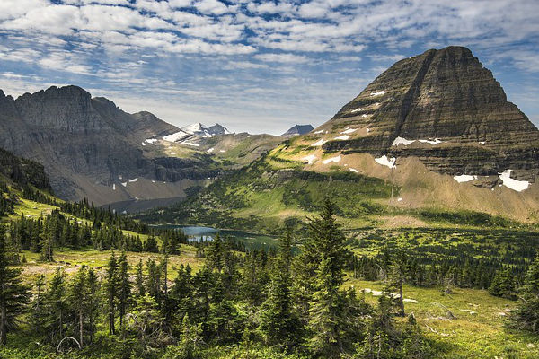
4. Hidden Lake Overlook Trail

View from Going-On-The-Sun Road. Photo by reverie-rambler.
- Difficulty: Easy
- Distance: 3 miles (4.8 km) roundtrip
- Best Time to Hike: Late June to early September. The trail can be crowded during peak season, so it's best to hike early in the day or later in the evening.
This is a 3-mile roundtrip hike that begins at the Logan Pass Visitor Center on the Going-to-the-Sun Road.
The trail takes you along a boardwalk and through alpine meadows before reaching a stunning overlook of Hidden Lake and the surrounding mountains.
This is a relatively easy hike with only about 500 feet of elevation gain, but it can be crowded during peak season.
5. Avalanche Lake Trail
- Difficulty: Moderate
- Distance: 4.6 miles (7.4 km) roundtrip
- Best Time to Hike: Late June to early September. This trail is also popular, so it's best to hike early in the day or later in the evening.
This is a 4.6-mile roundtrip hike that begins at the Trail of the Cedars trailhead on the west side of the park.
The trail takes you through a beautiful forest and along Avalanche Creek before reaching the stunning Avalanche Lake, which is surrounded by towering mountains.
This is a moderately challenging hike with about 750 feet of elevation gain, but the scenery is well worth the effort.
6. Swiftcurrent Pass Trail
- Difficulty: Hard
- Distance: 14.8 miles (23.8 km) roundtrip
- Best Time to Hike: Late June to early September. This trail is less crowded than some of the others in the park, so it's a good choice if you're looking for a more secluded hiking experience.
This is a challenging 14.8-mile roundtrip hike that begins at the Swiftcurrent Trailhead in Many Glacier.
The trail takes you up and over Swiftcurrent Pass, which offers stunning views of the surrounding peaks and valleys.
This is a strenuous hike with about 2,700 feet of elevation gain, but the incredible scenery is well worth the effort.
Ptarmigan Tunnel Trail

Elizabeth Lake in Glacier National Park from Ptarmigan Tunnel with Natoas Peak (left) to Steward Mt (right). Photo by Chris M Morris.
- Difficulty: Hard
- Distance: 10.3 miles (16.6 km) roundtrip
- Best Time to Hike: Late June to early September. This is a strenuous hike with a lot of elevation gain, so it's best attempted by experienced hikers who are prepared for the challenge.
This is a challenging 10.3-mile roundtrip hike that begins at the Swiftcurrent Trailhead in Many Glacier.
The trail takes you up and over Ptarmigan Wall before entering a tunnel in the mountain that offers incredible views of the surrounding peaks and valleys.
This is a strenuous hike with about 2,300 feet of elevation gain, but the unique experience of hiking through a tunnel in the mountains makes it well worth the effort
Hiking in Glacier National Park FAQ
When is the best time to hike in Glacier NP?
The best time to hike in Glacier National Park is typically from late June through September when the weather is generally milder and the park's trails and facilities are fully open. During this time, the park's famous Going-to-the-Sun Road is also fully open, providing access to many of the park's most popular trails and scenic vistas.
That being said, the weather in Glacier National Park can be unpredictable and can vary greatly depending on the elevation and location within the park. It's important to check weather conditions and trail conditions before setting out on any hike and to come prepared with appropriate clothing and gear for changing weather conditions.
Additionally, it's worth noting that some trails may be less crowded during the shoulder seasons of May and early June or late September and October, but there may be more limited services and amenities available during these times.
When do most Glacier National Park trails open?
Most trails in Glacier NP open in June. The Highline Trail is the one trail that is often closed due to snow. It usually opens on July 4th. On most lower elevation trails, the snow areas melt out either by late April or early May. Grinnell Glacier opens in Late July until October. If you are looking to confirm whether a specific trail is open, check the National Park Service’s Trail Status Reports.
How much are Glacier National Park entrance fees?
To enter Glacier NP, you will have to pay an entrance fee.
There are single day permits, 7-day permits, and annual passes available. If you are looking to stay at the park, there are several options for lodging and camping. It is recommended to make reservations for your accommodation in advance. For backcountry camping, you must make a reservation and pay a small fee.
The Park has recently closed all waters to motorized and trailered watercraft due to the increase of invasive mussel species.
Here are the current permit fees (these may have changed):
- 1 day: $15
- 1 week: $20
- Motorcycle 1 day: $25
- Annual Pass: $50
- Free Days: January 15th Martin Luther King Jr. Day, April 21st First Day of National Park Week, September 22nd National Public Lands Day, November 11th Veterans day.
Can I camp in Glacier National Park?
There are over 13 drive-in campgrounds. Some camping areas require you to reserve in advance, check in upon arrival, and a per night fee of $10-$23 a night. These campsites are Fish Creek, St. Mary, Apgar, and Many Glacier. Other camp areas are one a first-come-first serve basis.
Is driving along the Going-to-the-Sun road worth it?
Yes! It is one of the most famous aspects of Glacier National Park. It is completely free and takes 2 hours and 50 minutes to drive. The views are absolutely spectacular and you may recognize them from some famous films like The Shining and Forrest Gump.
What other activities are there in Glacier Park?
Hiking at Glacier National Park requires several pieces of gear. The hikes moderately long and may vary in temperature. This is why it is important to dress in layers, wear proper sun protection, and bring plenty of water and food. When hiking along the Grinnell Glacier Trail bear spray is a smart idea. If camping overnight in Glacier Park, bring bear-resistant food storage.
To help you plan and prepare for your hike, we recommend reading our gear section and hiking gear list.
What type of topography might I experience on a Glacier NP hike?
Glaciers from the last ice age have formed the mountain peaks we see today. Although, due to climate change, the glaciers have vastly disappeared and decreased to only 26 remaining in the park. Glacier National Park run a Global Climate Change research program by the U.S. Geological Survey agency to monitor and analyze data of the melting glaciers.
The park has dozens of large lakes, Lake McDonald being the longest and deepest at 9.4 miles long and 464ft deep. The geology of the park is primarily sedimentary rocks dating back 1.6 billion to 800 million years ago. There are over 6 mountains in the park exceeding 10,000 ft, Mt. Cleveland being the tallest. Climbing is becoming increasingly popular in the park as there are 6 official technical peaks sponsored by the Glacier Mountaineering Society.
What wildlife and plants might I see in Glacier national park?
Plants and wildlife find the perfect ecosystems within Glacier National Park. Most of the ecosystems are highly preserved as they are near a glacier. These ecosystems are known as the “Crown of the Continent Ecosystem.” There are 1,132 plant species, 71 animal species, and 276 species of birds.
The park houses two threatened species of mammals including the grizzly bear and Canadian lynx. Other mammals that inhabit the park are the mountain goat, moose, elk, and mule deer. In regards to birds, expect to see the majestic bald eagle, peregrine falcon, and hawks flying above the park year round.
With 23 species of fish found in the park alone, fishing is a popular activity in the park. Especially for the cutthroat trout, northern pike, and mountain whitefish.
For the park’s protection, Wildland Urban Interface Fire Management manages and educates others within the community about fire prevention. They have ensured that all neighboring buildings are designed to be fire resistant.
What guidebook do you recommend for Glacier National Park?
For a fantastic guide of everything to do with Glacier National Park and the neighboring park in Canada, Check out the No products found. by Erik Molvar.
Where is Glacier National Park?
Glacier National Park is found in the northwest corner of Montana, USA. It is located within the Rocky Mountains where the nearest city is Columbia Falls. It is accessible by car and the nearest airports are Kalispell and Great Falls. The park encompasses 1 million acres of land, including some of the Canada-United States border.
There are always free maps and information available at the any of the 3-visitor centers. The Apgar visitor center is found in West Glacier, Logan Pass visitor center is found on the Continental Divide in the sub-alpine region of the park.
Lastly, the St. Mary visitor’s center is found on the east entrance of the park. If you are looking for brochures and maps digitally, you can find them here.
What interesting facts should I know about Glacier National Park?
- The park was established on May 11, 1910
- Connected to Waterton Lakes National Park in Canada, known as the “Peace park”
- Home to approx. 762 lakes
- Official symbol is a Mountain Goat
- 71 species of mammals, 276 species of birds
- Over 700 miles/1,126 km of trails
- 26 active glaciers
- Highest Mountain: Mt. Cleveland at 10,448 ft/3,190m
- Welcomed 3 million visitors in 2017
- Famous for Going-to-the-Sun Road, a 50 mile/80km scenic road in the mountains
- UNESCO World Heritage Site and part of Waterton Glacier International Peace Park

Browse more US National Park hikes
See our picks for the Best Hikes in America, or check out these popular hikes.
