This page provides a comprehensive and impartial guide to climbing Kilimanjaro via the Machame Route.
Machame Route Overview
The Machame Route is one of the most popular routes for those seeking to reach the summit of Kilimanjaro. According to statistics from Kilimanjaro National Park, about 50% of Kilimanjaro hikers choose to take the Machame route.
Offering great views of the surrounding landscape, the Machame Route is indeed a great choice for one's first visit to this beautiful mountain.
The Machame Route is a fairly difficult hike which includes an ascent up the steep Barranco Wall on day four and a further ascent up the side of Kibo on summit night. That said, the route doesn’t require any technical skills and is often trekked by recreational hikers with little mountaineering experience.
Covering a total of approximately 62 kilometres of trail, hikers can choose to traverse the Machame Route in either six or seven days. Both options include an acclimatisation day, during which hikers climb high and sleep low in preparation for the summit push.

Machame Typical Itinerary
The Machame route can be completed in 6 or 7 days. Below is a detailed itinerary for the Machame Route (six-day version).
Day 1
- Distance: About 11km, or 7 miles
- Trekking time: 5 to 7 hours
- Change in elevation: 1,195 meters
- Landscape: Rainforest
The first day of trekking begins with a drive from either Moshi or Arusha to Machame Gate, where trekkers will be introduced to their crew, which includes guides, porters and cooks. Packs are weighed to ensure they don't exceed 20 kilograms, and the porters arrange all the gear needed for the days ahead.
Beginning at Machame Gate (1,640 meters), trekkers ascend through a stunning rainforest growing on the southwest face of the mountain. A long day of trekking (5 to 7 hours) ends at Machame Camp (2,835 meters) on the border of the rainforest and the alpine region higher up the mountain. Trekkers arrive to the welcome sight of a fully assembled camp, and dinner is served.
Day 2
- Distance: About 5km, or 3 miles
- Trekking time: 4 to 6 hours
- Change in elevation: 1,015 meters
- Landscape: Rainforest; Low Alpine
Day Two sees trekkers making their way from Machame Camp (2,835 meters) to Shira Camp 2 (3,850 meters). The path takes you through scenic low alpine meadows and moorlands. At Shira Camp 2, trekkers are rewarded with their first views of the Kibo summit, and Mount Meru is visible in the East.
Day 3
- Distance: About 11km, or 7 miles
- Trekking time: 5 to 7 hours
- Change in elevation: 750 meters ascent, 700 meters descent
- Landscape: Low Alpine; High Alpine
On Day Three, a long and arduous hike is in store. Ascending from Shira Camp 2 (3,850 meters) to Lava Tower (4,600 meters) in the morning, this is a likely day to begin feeling the effects of the altitude. In the second part of the hike, the trail loses almost all of the altitude gained in the morning before ending at Barranco Camp (3,900 meters). The landscape drifts between low and high alpine zones, which are characterized by grassy moors and barren fields of volcanic rock, respectively.
Day 4
- Distance: About 9.5km, or 6 miles
- Trekking time: 8 to 10 hours
- Change in elevation: 780 meters
- Landscape: High Alpine
First thing in the morning on Day Four, trekkers are faced with an arduous scramble up the Barranco Wall, a 257 meter rock face which leads into the Karanga Valley. Once over the wall, the trail meanders towards Karanga Camp (3,960 meters). Eight-day trekkers will stop here for the night, gaining another valuable opportunity for acclimatization before their summit attempt. Trekkers on the six-day and seven-day routes will stop in Karanga Camp for lunch, then continue on towards the Mweka Trail and Barafu Camp (4,680 meters).
Day 5
- Distance: About 4.5km (3 miles) ascent and 11km (7 miles) descent
- Trekking time: 6 to 8 hours to the summit, followed by 5-8 hours of hiking to Mweka
- Change in elevation: 1,215 meters ascent, 2,795 meters descent
- Landscape: Glacial at the summit, and all preceding zones on the descent
It's summit day! However, you start hiking promptly at midnight. This is the most challenging portion of the entire route. Scrambling up a scree field in the pitch dark, many trekkers find that this is the point in the hike where they really begin to feel the effects of altitude.
Please Note: If you show serious symptoms of Acute Mountain Sickness, get help and descend as quickly as possible.
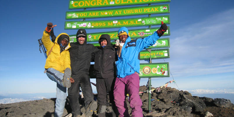
After 6-8 hours of hiking with a headlamp, you should reach the crater rim at Stella Point (5,739 meters). This is not the summit, but it is a good place to stop for some tea and to watch the sunrise. Uhuru Peak, the summit of Kilimanjaro, is another 156 meters higher. To reach it, you must traverse around the rim of the caldera. Keep going, you've already finished the hard part!
Once you've taken a few photos on the highest point in Africa, it's time to get going on the descent, which takes you another 7 miles(!) down to Mweka Camp (3,100 meters). To relieve stress on your knees, trekking poles can be very handy on the descent. At the end of the day, the rainforest surrounding Mweka Camp will be welcome relief from the inhospitable environment at the summit.
Day 6
- Distance: About 9km, or 5.5 miles
- Trekking time: 3 to 5 hours
- Change in elevation: 780 meters
- Landscape: Rainforest
During the last day on the Machame Route, you will descend gradually through a lush rainforest to Mweka Gate (1,640 meters). If you've reached Stella Point or Uhuru Peak on the previous day, you will be presented with an official certificate at the park gate. It is customary to tip your crew at this point, before your trip back to your hotel in Moshi or Arusha.
Machame Route Pros and Cons
Pros
- Can be completed on a 6 or 7 day route variation. The latter has better summit success!
- Good Walk High, Sleep Low profile which aids acclimatisation
- Excellent summit success rates. On the 7-day variation summit success rates are about 90%
Cons
- One of the busiest routes on Kilimanjaro
Machame Route Variations
The Machame Route is also operated as a seven-day trek.
For the seven-day version, trekkers spend the night at Karanga Camp (3,960 meters), gaining another valuable opportunity for acclimatization before their push up to Barafu Camp (4,680 meters) and the subsequent summit attempt, beginning at midnight after the noontime arrival to Barafu Camp.
Machame Route on Kilimanjaro FAQ
When is the best time to trek Machame?
June-September is the best time to climb the Machame route on Mt. Kilimanjaro. The weather is most stable during this period and encountering rain is less likely. That said, since Kilimanjaro is close to the equator it is possible to climb the mountain at any time of the year. April and May is the rainy season so this period is best avoided.
How difficult is the Machame trail?
The Machame Route, while being very popular, is considered one of the more difficult treks up Kilimanjaro. You will be trekking for 4-7 hours a day for about a week, gaining elevation every day. It's a good idea to work on your aerobic fitness before taking on the trek. That said, hikers of all ages regularly reach the summit via the Machame Route, and the success rate is generally considered to be above 90% on the seven day variation.
Is altitude sickness a risk on the Machame Route?
The Machame Route is designed to allow hikers some time for acclimatization before the summit push. That said, altitude sickness is a serious concern and trekkers should be informed of the risks, symptoms and warning signs before they go.
If you are particularly concerned about altitude sickness, the seven-day Machame Route is probably your best chance to reach the summit as it allows ample time for acclimatization.
Therefore, it is important to have a solid understanding of the risks associated with high altitude trekking and how the body acclimatises to high altitude.
See our detailed article on how to acclimate to altitude as a way of preventing or reducing altitude sickness.
How much does the Machame cost?
The costs of trekking the Machame Route is on average $2200. The cost will vary based on a few factors, such as what season you choose to hike, whether you choose the six or seven-day option, or whether you choose to use a Western guiding company or communicate directly with a local guiding company.
Here are the major costs to consider when planning to undertake the Machame Route:
- Visa, Vaccinations, Insurance etc: ~$300-$500
- Equipment (buying and hiring): ~$200-$300
- Flights to Kilimanjaro International Airport: ~$800
- Tour Agency: About $1,500 for a very cheap local agency (not recommended) to ~$3,500 for an expensive Western agency.
- Tips: ~$200-$300
- Misc (additional food, unplanned travel / hotels etc): $200
Total Costs: $3,200 – $5,100
What gear do I need for the Machame trail?
Trekking Mount Kilimanjaro requires a number of essential pieces of trekking clothing and equipment. You will be exposed to a range of altitudes where temperatures fluctuate dramatically between night and day.
To help you plan and prepare for your climb, we have created a detailed Kilimanjaro packing list.
Are permits required for the Machame hike?
A permit is required to climb Kilimanjaro. Furthermore, all trekkers must be accompanied by a guide and porters. If you are joining an organised tour, these will be arranged for you. Otherwise, speak to your hotel in Moshi or Arusha and they should be able to help you find a guide and obtain the necessary permit to climb Kilimanjaro.
What kind of insurance do I need for the Machame trek?
Trekking to the summit of Kilimanjaro carries with it certain inherent risks. Chief among these is the risk of altitude sickness. It's a good idea to look into travel insurance before your journey. Make sure your insurance covers trekking up to 6,000 meters, which does not come standard in most travel insurance packages.
Are there any alternative routes up Kilimanjaro?
Yes, there are. I highly recommend the Lemosho, Rongai and Northern Circuit routes as alternative routes to climbing Mount Kilimanjaro.
Continue browsing
See more information on Tanzania. Or check out these other Kilimanjaro Hiking articles:
