Bhutan's Snowman Trek is one of the hardest Himalayan treks and is considered to be one of the most difficult treks in the world! More people are said to have summitted Everest than to have completed the Snowman Trek.
On this page you will find a comprehensive and impartial guide to the Snowman Trek in Bhutan, including when to trek, difficulty and the typical itinerary for the trek.

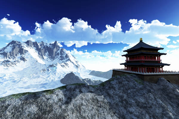
Snowman Trek Bhutan
For more than a decade now, publications have emphasized the pursuit of happiness over material possessions. There should be no doubt then that when hiking in Bhutan, you’ll be inundated with pure joy. This joy is probably stemming from the fact that you have completed one of the toughest treks in the world.
The Snowman Trek is challenging for a number reasons.
First of all, the window in which you can complete the trek is very small. Bhutan has an incredibly long rainy season; therefore, rain on the Snowman hike is very likely. It’s advised that the first 3 weeks of October is one of the best times to start, but even then, you are still competing with Mother Nature when it comes to altitude – the highest camp coming in at 5,050m – a mere 300m off the Everest Base Camp and 800m off the summit of Mount Kilimanjaro.
These facts will either put you off completely or drive you to dig out the inner adventure junkie and experience crossing ten high passes over 4500m in altitude over a period of 3 to 4 weeks (depending on which route you choose).
It is believed that since records began in 1982, only approximately 500 people have finished the Snowman hike.
Mention that you’re going on the Snowman Trek to any local bartender and you might be lucky enough to get a round of drinks on the house to make your mind hazy, briefly forgetting that you’re embarking on an epic adventure involving lakes, monasteries and white capped peaks in the morning.
The Takin (the national creature of Bhutan) might give you the odd look as if he knows a little secret, but it’s been recorded that the amount of international visitors to Bhutan at any one time stands at 1500 – so if you are seeking silence and anonymity of last night’s drinking habits – The Snowman Trek offers that and more.
Bhutan Regional Map
The Snowman Trek cuts through a variety of regions in the north-west of Bhutan. These include, Paro, Thimphu, Gasa, Punakha and Wangdue. The map below illustrates Bhutan’s main regions.

Snowman Trek Itinerary
The Snowman hike is an extension of the Laya Gasa Trek but is higher in altitude.
As mentioned, the weather is not your best friend, so sometimes you will be walking in ran or making camp on snow.
There are variations on the trek, but the itinerary below is the most common.
Bear in mind that past a certain point there are no hospitals, so caution is of the utmost importance as the costs involving a helicopter will be double the price of your adventure.
Below is a detailed outline of the 27-day Snowman Trek itinerary. Be sure to take regular breaks and sips of water as you read along.

Day 1: Paro, Taktsang Monastery
- Altitude: 3,120 feet
Your first port of call is the Bhutan town of Paro. It’s advised you spend some time in the town getting used to the high altitude that you will experience through most of the trek.
Bhutanese culture is on full show and since it’s a country that has a measure of happiness, you are bound to have a smile on your face. That smile will grow even bigger when you set your sights on the Tiger’s Nest (Taktsang Monastery). The monastery tops every tourist’s list of sights to see in Bhutan, its roots steeped deep in the history of Buddhism.
You may want to read: how to get to Bhutan and our guide to walking to the Tiger's Next Monastery.
Day 2: Paro – Shana
- Altitude: 9,251 feet
- Distance: 8.6 miles
- Time: 5-6 hours
After a short drive west from Paro, passing Drukgyel Dzong, an old fort that was built to commemorate a victory over an invasion from Tibet and is still mostly intact as far as ruins go, most treks start from an Army Camp, just on the outskirts of the Paro Chhu Valley. Visas are checked and then it’s off down the valley over suspension bridges and muddy trails towards Shana.
Day 3: Shana to Thangkthanka
- Altitude: 11,843 feet
- Distance: 13 miles
- Time: 7-8 hours
Most of the day is taken up by walking through a heavily dense forest, home to the occasional isolated farmhouse. This is one of the many places where a variation in the trek can occur with Tremo La just north. Most camps are set up on a meadow, so just be sure you’ve arranged with some animals where you are sleeping as they might view your tent as a new local delicacy.
Day 4: Thangthangka – Jangothang
- Altitude: 13,500 feet
- Distance: 9.3 miles
- Time: 5-6 hours
If you haven’t previously (highly likely because of cloud coverage); you should unzip your tent cover and be blessed with a view of the “bride of Kangchenjunga” - Mt. Jhomolhari (or Chomolhari). More army posts and juniper forests are the order for the day. If you are lucky enough, you might come across a farmhouse near Tengethang that will allow you to try the local thomba (a local beer equivalent).

Day 5: Rest Day In Jangothang
After 4 days, the first rest day of the trek, and more than anything it is used for acclimatization purposes. There are a lot of one day hiking options but don’t be confused – climbing Jhomolhari is prohibited from the Bhutan side.
There is 2-hour hike to a lake above camp where you can capture amazing photos of Jitchu Drake for that Instagram feed.
At this stage, you would have ascended nearly 6000 feet, so if the thought of hiking is the last thing on your mind, you have some spectacular peaks to stare at for 24 hours.
Day 6: Jangothang – Lingshi
- Altitude: 13,123 feet
- Distance: 10.5 miles
- Time: 6-7 hours
When you wake up – prepare yourself for one of the longest days of trekking. The day is mostly spent crossing over the Nyile La Pass which stands at 15,419 feet.
You’ve got even more chances of taking wonderous shots of Jhomolari, Jitchu Drake and Tsheri Kang (a mountain situated on the Chinese-Bhutanese border).
You’ve even got a chance to cross the spot where Micahel Palin met with an old Bhutanese composer on his Himalaya series and the chance to see herds of blue sheep.
Day 7: Lingshi – Chebisa (via Gang Yul)
- Altitude: 12,401 feet
- Distance: 7.5 miles
- Time: 4-5 hours
Going from one of the hardest days, there is a complete 180-degree change to one of the easiest days of the trek. Lingshi Dzong is along the way; also known as Yugyel Dzong, it was another border post controlling the travel between Tibet and Bhutan. A guided tour by the monks in the monastery is on the cards, depending on whether your tour operator can arrange it. Although not required, it’s advised to leave a small donation.
From there, a hillside path meanders along to the “village at the pass” – Gang Yul. This village lies in the shadow of Jitchu Drake and is home to about 150 people who are very welcoming of visitors, who knows, you might even be invited inside for some chang and rice. An hour outside the village is Chebisa where a camp should be made.
Day 8: Chebisa – Shomuthang
- Altitude: 13,100 feet
- Distance: 10.5 miles
- Time: 6 hours
Starting out – a steep climb through pastures till the Gombu La Pass, which stands at 14,300 feet, and then down forests of dwarf rhododendron which give way to bushes of yellow and crimson berberis. A photographer’s paradise. More folks of blue sheep should pattern the valley. It’s almost as if you wanted time to stop as these forms some of the most beautiful imagery the trek has to offer.
Day 9: Shomuthang – Robluthang
- Altitude: 13,451 feet
- Distance: 13.6 miles
- Time: 7-8 hours
An early start to Jhari La Pass provides views of Kang Che Da and your objective for the next day that is the Shinge La pass. It’s here that those fears might arise again as the pass forms the lowest point of the horizon. Those fears can be placated by walk through the pine forest in Tsharithang, the scenery having inspired Victor Saunders to say that this was his best walk. Depending on the season a knee deep river is the last obstacle before your camp on Robluthang.
Day 10: Robluthang – Limithang
- Altitude: 13,254 feet
- Distance: 8.5 miles
- Time: 6-7 hours
Day Ten is another hard day of the trek. But this time the reward is you standing on top on the world. A climb up Sinche La Pass (15,977 feet) boasts views of Gangchhenta – “Great Tiger Mountain”. It’s from this vantage point that all the northern borders are visible. Save enough energy from looking at all these views to place a stone on one of the four cairns that signal the end of the climb. A gradual descend into Limithang where camp is set up.
Day 11: Limithang – Laya
- Altitude: 12,729 feet
- Distance: 6.2 miles
- Time: 4-5 hours
If you’re into bird spotting, then there is no better day for it. Characterized by a lot of up and downs, the walk descends into the village of Laya where the villagers are famous for yak hair clothing and bamboo hats.
As we are close to the border, the features of these villagers are more in line with Tibetan or Mongolian than Bhutanese. Even so, their hospitality is just as welcoming. Depending on your time of trek, most fields surrounding the village are harvested and provide a flat surface on which to camp.

Day 12: Rest Day in Laya
- Altitude: 12,729 feet
A rest day in the village and it’ll be your first opportunity since Paro to stock up on supplies and check in with the local hospital. If you fancy on recreating some Robin Hood archery feats, you could challenge some of the locals.
Day 13: Laya – Rodophu
- Altitude: 13,451 feet
- Distance: 10.5 miles
- Time: 6 hours
The day starts out with an easy descent to Tashi Makhang army camp where another checkpoint awaits you. During Monsoon season the region receives a large portion of rainfall resulting in a very lush part of the trek. Look out for the turn off to Rodpophu as it is quite well hidden. This probably to hide the steep ascent through mud encrusted trails.
Day 14: Roduphu – Narethang
- Altitude: 16,200 feet
- Distance: 6.2 miles
- Time: 6-7 hours
A three hour climb to Tsemo La Pass is the main obstacle of your second week of the trek. Whilst ascending, views of Gangla Karchung as well as Jhomolhari and Gangla Karchung will surround you and your deep breathing body as the first high camp beckons on top of Narethang, situated between the Tsome La and Karakachu La at 16,200 feet.
Day 15: Narethang – Tarina
- Altitude: 12,795 feet
- Distance: 15 miles
- Time: 8-9 hours
Another 2-3-hour climb starts the day as you are headed towards the Karakachu La Pass that, once over, provides the greatest mountain panorama in Bhutan. All mountains rise above 23,000 feet including the Tshendayang Group, Teri Gang and Masakang. Considering that not many people even finish the trek, this view has only touched a handful of eyes.
After your eyes have had your full of mountains, descend down into the Tarina Valley. This is quite long, sometimes taking the better part of 4 hours before you reach the valley floor. Camp is alongside a river at place known as Tarina. Fill those lungs with oxygen richness as the camp is several hundred feet lower than last night.
Day 16: Tarina – Woche
- Altitude: 12,656 feet
- Distance: 7.5 miles
- Time: 5-6 hours
A respite from long up and down climbing, the trek today follows the river down through absolute peace and quiet, the odd bird overhead the only reason silence could be broken. A climb of 300m is the only arduous part of the day as you climb to Woche Village. That silence is broken by a healthy reception of villagers who are part of a settlement that consists of a mere 3 or 4 huts. You are now starting to enter the Lunana region of the trek.
Day 17: Woche – Lhedi
- Altitude: 11,942 feet
- Distance: 9.3 miles
- Time: 6-7 hours
Keche La Pass at 15,305 feet forms the main thrust of the day. Starting through a forest and then out onto open countryside, with views of even more unscalable
Mountains (Kangphu Gang and Jeje Kangphu) to the north, the 3 hours from Woche to Keche La is breathtaking. South Africans and any visitors that have been to Cape Town will get to see the other famous “Table Mountain” - Zongophu Gang. Camp is at Lhedi.
Day 18: Lehdi – Thanza
- Altitude: 13,320 feet
- Distance: 9.3 miles
- Time: 6-7 hours
Most of the day is spent following the Pho Chu River along the riverbed. This part of the trail might require porters depending on your luggage load, so keep that in mind. Along the way, you’ll pass another Dzong, (Chozo Dzong) which have been scarce over the past two weeks. After three of four hours past Chozo Dzong, you’ll reach the villages of Dyotta and Thanza. Interesting to note is that the language spoken here is different to main language of Bhutan, Dzongkha.

Day 19: Rest Day in Thanza
If you are a linguist, then maybe you’ll have time to decipher the language differences between the villagers of Thanza and the rest of Bhutan. If not – walk up to the lakes surrounding Thanza will provide stunning views of Table Mountain.
— It’s here that a lot of variations in the trail occur —
Day 20: Thanza – Danji
- Altitude: 15,000 feet
- Distance: 4.9 miles
- Time: 4-5 hours
A part of the trek on which you can reflect on how much climbing you’ve done, as the views offered enroute to Danji detail a lot of your journey already. This is used as another acclimatization point on your trek. Two different options for continuing the Snowman Trek are around the area; one heading east to Tsorim, and the other heading south to Sephu.

Day 21: Rest Day
This can either be another rest day or you have the Option to Ascend Gorphu La – 17,159 feet (A view to the world’s highest unclimbed peak).
Day 22: Danji to Tsochena
- Altitude: 16,570 feet
- Distance: 7.4 miles
- Time: 5-6 hours
This marks the exit from the Lunana region as you climb through three false summits up till Jaze La (16,570 ft). From there it’s a short trek to down to Tsochena Lake.
Day 23: Tsochena to Jichu Dramo
- Altitude: 16,300 feet
- Distance: 11 miles
- Time: 4-5 hours
Following the shoreline of the Tsochena Lake, you’ve got the opportunity for another grand 360 viewpoint. Crossing the Loju La pass you descend into Jichu Dramo camp.
Day 24: Jichu Dramo to Chukarpo
- Altitude: 16,335 feet
- Distance: 11 miles
- Time: 6-7 hours
Straight out of leaving camp you’ve got a tough climb to Rinchen Zoe La (17,454 ft); the highest pass of the route. Which brings with it amazing mountain scenery including Rinchen Zoe Peak (18,536 ft). Once over the pass, you’re onto a valley and along to Tampe Chu. A few more hours descend and you’ve reached Chukarpo.
Day 25: Chukarpo to Tampe Tso
- Altitude: 14,107 feet
- Distance: 11 miles
- Time: 7-8 hours
The descent continues as you make your way down, following the Tampe Chu river down to Gala Pang Chu then up to Thampe Tso, sitting at 13,860 ft) a beautiful blue lake.
Day 26: Thampe Tso to Maurothang
- Altitude: 15,100 feet
- Distance: 8 miles
- Time: 5-6 hours
From Thampe Tso, you are moments away from the final pass, Thampe La (15,091 ft). Blue sheep roam freely again as you descend down to the sacred lake Om Thso. As tempting as it might be, do not enter into a competition for stone skipping as it is forbidden to throw anything into the lake. Waterfalls shower drops of water onto you as enter Maurothang on the banks of Nikka Chu.
Day 27: Maurothang to Sephu
- Altitude: 11,154 feet
- Distance: 10 miles
- Time: 7-8 hours
After a culmination of nearly a month, the trek ends as you make your descent 10,000 ft to the village of Sephu. The Nikka Chu Bridge marks the end of most treks and the validation to say you have completed one of the most gorgeous, difficult treks on Planet Earth. Transfers from Sephu back to Paro are easy enough to organize, you could even ask your driver to make a stop to the Dzong in Trongsa.

Snowman Trek FAQ
How much does the Snowman Trek cost?
On average, Snowman trekking tours range from $5,500 to $9,000. For most of them, this does include transportation in Bhutan, meals and hotels.
When is the best time to complete the Snowman Trek?
The best time of the year to complete the Snowman Trek is from mid-June to mid-October, with September being the most optimal. As with most treks in Bhutan, you can be guaranteed that there will be rain.
You may also like: Best time to visit Bhutan

Are permits required for the Snowman Trek?
You don't need a permit for the Snowman Trek, but you do need a visa for entering Bhutan in order to complete the trek.
At one point, Bhutan used to regulate the number of tourists, but nowadays, it’s an open-door policy provided you have a visa. Visas are processed through an online system by your licensed Bhutanese tour operator or through a foreign travel agent.
Visas are processed by the Tourism Council of Bhutan and once a full payment of your holiday plus a USD $40 visa fee has been received, visas are issued.
There is also a Government Royalty fee plus taxes. Most tour operators will arrange payment of this fee for you.
How difficult is the Snowman Trek?
To complete the Snowman Trek, you will need to be in peak physical condition as reaching the summit can be quite challenging.
Make sure to check with your doctor of the hazards of high altitude climbing and its effects on your body. With altitudes reaching above 17,000 ft, it’s advised to find an altitude centre near you.
Other points to help you prepare for the Snowman Trek:
- A good diet
- Weekends hiking in an altitude that is as high as possible
- Long endurance exercises in the gym
- Get used to carrying any gear that you may have bought for the trek
Is altitude sickness a risk on the Snowman Trek?
Yes. The Snowman Ascends to some very high altitudes and crosses over 11 mountain passes! Therefore, it is essential to have a thorough understanding of the altitude risks involved with this trek.
Please read our detailed section on altitude sickness and acclimatization.

What gear do I need for the Snowman Trek?
As with any trek – pack light and efficiently for the Snowman Trek. Layers of clothing are essential and it’s best to source quick drying materials wherever possible.
Bhutan is highly conservative and it is advised to cover as much skin as possible – legs and shoulders should be covered. Here are some suggested items for your packing list:
Clothing:
- High Quality Socks (4-6 pairs as the mud and water will certainly have you changing them often)
- Quick Dry Towel
- Sufficiently Shaded Hat
- Underwear
- Long and Short Sleeved Shirts
- Fleece
- Long trekking trousers
- Waterproof Jacket
- Warm winter jacket (down or synthetic)
- Light Shoes or Sandals for evening use
- Parka
Trekking Gear
- Daypack (35-45L)
- Duffle bag (90L) for your main gear
- Hiking Boots
- Four season sleeping bag
- Water Bottle or Hydration bladder
- Trekking Poles
Miscellaneous Items:
- Sunscreen
- Toiletries
- Sunglasses
- Headlamp
- Medical Kit
To help you plan and prepare for your trek, we have written a detailed packing list for multi day hikes.
Do you recommend any guides or guidebooks for the Snowman Trek?
Absolutely. The Snowman Trek requires vast knowledge of the route before setting out. It is highly advised that you join a trekking company who employ the use of guides who know the region. It is in this author’s experience that no one attempts the Snowman Trek by herself or himself.
We recommend Bhutan Lonely Planet as our preferred guidebook.

Are there other trekking routes through Bhutan?
Definitely. The Snowman Trek isn't the only trekking route that offers unforgettable sights and first-hand experience of Bhutanese culture.
We highly recommend the Chomolhari Trek, the Druk Path Trek and the Tiger's Nest Trek which leads to Paro Taktsang, the world-famous Buddhist monastery.
Continue browsing...
See more information on Bhutan. Or check out these other Bhutan Hiking articles:


Thank you for such a great detailed and inspiring review, Mark! Could I ask whether there is a local trek agency you would recommend (or avoid altogether!), and also, whether the agency provides your food and camping gear? We have trekked in Nepal as autonomous travellers but it looks like you cannot just rely on finding teahouses and warm meals along the road as you would on the other side of the border? Thank you for your help 🙂
Hi Helene, it’s been many years since I was in Bhutan so unfortunately I’m not connected with any local guides. You may be able to find a local guide on Skyhook: https://www.skyhookadventure.com/
Never knew Bhutan was such a spectacularly beautiful country. You just gave me my 50th birthday goal :))
Looks fab! You may want to convert the “metres” shown, as I believe you have the feet displayed as metres e.g. Mt Everest looks small compared to this 🙂
Thanks Raymond, that was a typo.