The Ice Age Trail, or IAT, is one of 11 National Scenic Trails in the U.S. This is the same prestigious group that includes the country's famous Appalachian Trail and Pacific Crest Trail. The IAT traces the terminal moraine of North America's last glaciation and lies entirely in the state of Wisconsin, known for having some of the world's finest glacial remains.
Here are answers to some of the most frequently asked questions about hiking the Ice Age Trail. Check them out to get ready for your next hiking adventure.
Ice Age Hike (12 FAQs)
When is the best time to hike the Ice Age Trail?
The best time to hike the Ice Age Trail is during the fall, ideally mid-September to November. The weather is cool then, the bugs are gone and the fall colors are spectacular. Spring hikes (April to May) are also a good option, although the trail may be wet and muddy, and ticks are often a problem.
If you prefer to hike in the summer, be aware that summer in Wisconsin can mean temperatures in the 80s and even 90s Fahrenheit (27-32 C), with high humidity. Mosquitoes, black flies and other biting insects are also problematic.
Winter hikes are possible if you dress in warm layers and wear snowshoes and/or ice cleats (as needed). However, winters in Wisconsin can be quite cold, with temperatures in the single digits or below zero Fahrenheit (-13 to -18 C). Most people hiking the IAT in winter just hike small sections on temperate days.

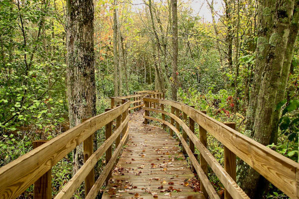
Melanie Radzicki McManus jogs past one of the many glacial erratics that can be seen on the Ice Age Trail. Photo by Gary Knowles
How long does it take to hike the entire trail?
Most people take eight to 12 weeks to hike the Ice Age Trail.
Is it easy to camp along the trail?
The IAT passes through both public and private land. It's imperative to respect private property, and even on public land you aren't allowed to camp wherever you'd like. However, with planning, it's certainly possible to camp along the entire trail.
Primitive campsites are found in the trail's northern tier, generally where the trail passes through county and national forests. These sites have no facilities, and no permits or reservations are needed.
The Ice Age Trail Alliance and its partners have also created 21 Dispersed Camping Areas, or DCAs (as of 2020), many of which are in the trail's south-central region. DCAs are clearly marked and, like the primitive sites, have no facilities and need no permits or reservations.
In the Kettle Moraine State Forest (southeastern Wisconsin) and Chippewa Moraine State Recreation Area (northwestern Wisconsin), trailside shelters are available with advance reservations.
Finally, the trail passes by or near many public and private campgrounds. Many of these require a reservation and/or fee.

Photo by Melanie Radzicki McManus
How challenging is the hike?
The Ice Age Trail winds up and down many hills and towering glacial features, such as eskers, which can be challenging. However, it doesn't run along any mountain ranges, and its highest elevation is 1,920 feet (585 m). Most would consider it a moderately challenging hike.
Do I need any permits to hike the Ice Age Trail?
Nope! Just make your way to the eastern terminus in Sturgeon Bay or the western terminus in St. Croix Falls and start hiking.
How easy is it to resupply along the trail?
It is easy to resupply along the Ice Age Trail. First, as the trail follows the terminal moraine of the last North American ice sheet, it passes through whatever towns happen to lie along the terminal moraine. So you can resupply in these towns and/or pick up packages you've mailed to yourself at the local post office.
Second, while the Ice Age Trail is more than half completed, it still requires thru-hikers to walk along about 500 miles (805 km) of connecting road routes. While these are typically scenic paths through the quiet countryside, they occasionally pass convenience stores that offer food and supplies.
Finally, the Ice Age Trail has a robust group of Trail Angels eager to assist hikers via shuttles, lodging and trips to grocery stores or sports retailers for resupply purposes.

Photo by Melanie Radzicki McManus
What dangerous wildlife might I encounter?
Black bear are prevalent in the trail's northern half, along with wolves – probably hikers' two main concerns. However, as with most wildlife, these animals do not want to be near humans and will typically run away if you encounter them.
Farm dogs are a more common concern. You may encounter some on the connecting road routes that act aggressively toward passing hikers.
Do I have to be concerned about hunting along the trail?
The Ice Age Trail does pass through land that is shared with hunters. So make sure you know the state's various hunting seasons before you set out, and wear blaze orange if you will be hiking during this time.
In addition, a few private landowners who host portions of the IAT on their land elect to temporarily close their sections during specific hunting seasons. These segments are noted in the Ice Age Trail Guidebook.
How can I get in touch with other Ice Age Trail thru-hikers?
One of the best ways to meet other IAT hikers is to join the Facebook group Thousand Miler WannaBes. You'll quickly connect with others hiking the trail, people knowledgeable about various segments, those willing to help with shuttles and more.
In addition, the Ice Age Trail receives a lot of assistance from its 20 volunteer chapters, many of which also have Facebook pages, such as the Central Moraines Chapter (Marathon County).
The Ice Age Trail does not have a yearly Facebook page (e.g., Ice Age Trail Class of 2020), like some of the other National Scenic Trails do.
Which terminus do most thru-hikers start from?
A few years ago, most thru-hikers began from the eastern terminus in Sturgeon Bay. For reasons no one at the Ice Age Trail Alliance knows, most thru-hikers today start at the western terminus in St. Croix Falls. Either option is fine.
While most U.S. long-distance trails pass through several states with varying climates, which impacts the direction in which you should travel, the IAT is all in one state with the same climate. So either terminus works.
How well-marked is the trail?
The Ice Age Trail is marked with yellow rectangular blazes and its official National Park Service symbol, which is a wooly mammoth inside a rounded triangle. In general, you can expect to see blazes every quarter-mile or so.
However, the Ice Age Trail Alliance is in the (lengthy) process of standardizing all of its signage. So in some places, the trail may be marked with older small, brown signs with a yellow arrow, larger yellow signs with a black arrow, metal posts with yellow-painted tops, etc.
In addition, the northern section of the trail passes through a lot of areas that are being actively logged. It's not uncommon for loggers to cut down trees with blazes and not realize they've done so, or to neglect to notify the Ice Age Trail Alliance when they have removed blazed trees.
To make sure you don't get lost, it's best to purchase the IAT trail app from Atlas Guides and/or the Alliance's set of maps. They also have a great printed guidebook, too.

Photo by Melanie Radzicki McManus
What gear do I need?
General Equipment
- Backpack: The size will depend on whether or not you'll be camping or day hiking.
- Tent or Hammock
- Hiking Boots or Shoes: You can easily hike the IAT in a quality pair of trail shoes, such as those made by No products found. or No products found.. But if you prefer lighter running shoes or sturdier hiking boots, those work, too.
- Sleeping Bag or Quilt
- Sleeping Pad
- Trekking Poles: While these are not required, they definitely come in handy on all of the hills. They're also useful in checking water depths, as potential protection against animals, etc.
- Cooking Stove and Accessories
- Water filter: You can probably get by with purchasing water as you go, or filling up at public water fountains. However, it's best to be prepared to filter water, especially in the trail's remote northern tier.
- Headlamp
- First Aid Kit
- Sunscreen
- Bug Spray
- Power Bank
- Cell Phone
Clothing
- Puffy (down) jacket: Even if you hike during the summer, it can get cool in the evenings.
- Rain pants and jacket
- Fleece top and/or lightweight vest
- Base layer top and bottoms
- Lightweight hiking pants: It's tempting to hike in shorts, especially if the weather is warm. But it's not recommended during tick season, which is roughly April through mid-September. The worst months are April, May and June.
- Socks: Select those made from wool or technical materials.
- Gloves
- Neck warmer or balaclava - Tough Headwear make great neck warmers
- Sun hat
- Gaiters
- Compression and/or sun sleeves
- Compression sleeves for your arms can be a great, lightweight choice for cool mornings. Switch to sun sleeves when it's hot out. Calf sleeves also work well for extra warmth and protection.
- Camp shoes: Try Vivobarefoot, my faves.

Photo by Melanie Radzicki McManus
You may also like...
See our detailed guide to North American mountain ranges. Or check out our country and State hiking guides below.
Also see our detailed Mountain Guides or explore our Hiking Tours available exclusively on Mountain IQ.
Here are some more of my hiking experiences: Hope Pass, part of the Legendary Leadville Trail in Rocky Mountains.

Is there a problem with the Thousand Milers WannaBes? I’ve been trying to join without any success for awhile. I’d like more information. Thanks
Hi Frank, unfortunately I don’t know. The group seems active so not sure why they haven’t let you join. Perhaps try find an email for them.
Gail Piotrowski and Theresa Werner are the page's admins. You can use Messenger to ask one of them about joining if you're having problems.