Looking for advice on hiking the GR10 trail? We have put together the best of the GR10 trail to help you along your way.
The GR10 runs the length of the Pyrenees Mountains. Roughly 900 km, it takes about two months to complete it in entirety.
In this article you'll find useful information to help you get ready for tackling the GR10, whether you plan on attempting the whole hike in a single go or breaking it into more manageable, less time-consuming sections.
The GR10 - The Route
As the GR10 is 559.2 miles (900 km), the journey can be split up into sections. Along the route you can find accommodation. although more remote areas require one to be self-sufficient. Most of the huts and hostels on the GR10 are accessible by car.
Generally the GR10 is hiked from Hendaye to Banyuls, but it can be hiked in either direction. Most guides begin in Hendaye and work onwards, however, there is no set way to hike the trail.
GR10 Trail Top Tips
- All GR trails are clearly marked by red and white symbols that mark if you need to turn left, right or have gone the wrong way.
- Remember to always be prepared for any weather, particularly if you are doing a longer hike. It is a good idea to take sun protection as well as a good quality rain jacket on your journey.
- Although the trails are clearly marked by the GR markers, it is still a good idea to take a map with you - as using just the trail as navigation can be tricky.
- The gites (hostels) along the way mean that you can eat breakfast and dinner along the way and won’t have to carry lots of supplies. If the weather is good you can choose to stay outside, but if things are looking miserable you can easily pay for a bed in a gite.
8 Best GR10 Hikes
1. Hendaye to St Jean Pied de Port

Photo by Davey Family
- Area: Pays Basque region
- Difficulty: Moderate
- Distance: 60.9 miles (98 km)
- Days/Hours: 7 days
- Best Time to Go: Spring early summer or late summer to early fall
Route Description
This section of the GR10 begins in the town of Hendaye, France, on the Atlantic coast. On day 7 you will arrive at St Jean Pied de Port.
The route is dotted with traditional villages and rolling hills, with the mountains beckoning in the distance.
Arriving in Jean Pied de Port, you can either decide to continue onwards or just hike this section, it all depends on your preference. The average walk per day will take between 4.5 to 7 hours, depending on the day and your fitness.
Outline
Day one begins at Hendaye and ends at Olhette. Day two then moves on to Sare. On day three you will head from Sare to Ainhoa.
Moving on from Ainhoa, day four takes you to Ferme Esteben. Day five you walk onwards to Bidarray. From Bidarray, day six takes you to St Etienne de Baigorry. The last day (seven) of this section takes you to St Jean Pied de Port.
Video Overview
Watch the first part of the GR10, from Hendaye to St Jean Pied de Port. Kimhike’s video gives you a good idea of what to expect in terms of breathtaking scenery and landscapes.
2. St Jean Pied de Port to Etsaut

Photo by Sarah Busby
- Area: Pays Basque region South-Western France
- Difficulty: Moderate to difficult
- Distance: 74.5 miles (120 km)
- Days/Hours: 6 days
- Best Time to Go: Spring early summer or late summer to early fall
Route Description
The second section of the GR10 covers the remaining Pays Basque region. Beginning in St Jean Pied de Port, the section is generally done in 7 days, with the final day you will arrive Etsaut.
This is situated at the entrance of the famous Pyrenean Parc National. As before, you can just hike this section or continue onwards.
Outline
Day one of the second section of the GR10 begins where you left off at St Jean Pied de Port, the trail then continues to Phagaloette.
From here, on the second day, you will walk to Iraty.
On day three you will hike from Iraty to Logibar, with spectacular views of dense forests along the way. After arriving at Logibar, on day four the GR10 makes its way to Senta.
From Senta you will walk to Lescun, with the seventh day bringing you to Etsaut.
3. Etsaut to Cauterets

Photo by Ducombs Alain
- Area: Region of Occitanie in south-western France
- Difficulty: Moderate to difficult
- Distance: 54.6 miles (88 km)
- Days/Hours: 7 days
- Best Time to Go: Spring early summer or late summer to early fall
Route Description
This third part of the GR10 enters the Pyrenean National Park. The trail takes 6 days and you will end in the mountain village of Cauterets - much is well known for their thermal spa.
The hike takes you through the National Park, offering you amazing views of the Ossau valley.
Outline
Day one of this third section takes you from Etsaut to Refuge d’Ayous, with the second day taking you to Gabas.
From Gabas you will hike to Gourette, with a steep climb up to Hourquette d'Arre.
Day four you will leave Gourette and end at Arrens. Hereafter, on day five, you will arrive at Lleeou refuge.
Day six will end your journey at Cauterets - where you can either travel onwards or head home.
Video Overview
Have a look at this Dodane's video of their 3 week-trekking overview on the GR10 - from Hendaye to Cauterets.
4. Cauterets to Luchon

Photo by David James Goldsworthy
- Area: Region of Occitanie in south-western France
- Difficulty: Moderate to difficult
- Distance: 74.5 miles (120 km)
- Days/Hours: 7 days
- Best Time to Go: Spring early summer or late summer to early fall
Route Description
The fourth section of the GR10 takes you into the Pyrenees Mountains where you can discover and appreciate amazing flora and fauna, as well as high mountain passes and glacial lakes.
Accommodation
Day one you will depart Cauterets and walk to Luz Saint Sauveur.
Day two will then take you from here to Bareges. From Bareges day three takes you through the beautiful natural reserve of Néouvielle, and you will overnight in Lac de Orédon.
Day four then takes you to Saint Lary Soulan, with day five’s walks heading onwards to Espingo Refuge.
From Espingo day six takes you to the final destination of Lunchon. After spending night seven here you can travel onwards to section 5 of the GR10.
Video Overview
In this video Sanu Wah shares her 8-day trekking experience from Luz St Sauveur to Bagnères de Luchon in High Pyrenees.
5. Luchon to Aulus les Bains

Photo by Peter Wolbink
- Area: Region of Occitanie in south-western France
- Difficulty: Moderate to difficult
- Distance: 96.3 miles (155 km)
- Days/Hours: 7 days
- Best Time to Go: Spring early summer or late summer to early fall
Route Description
This part of the GR10 follows ancient pathways that have been means of transport through the deep valleys.
The route begins in Luchon and winds its way through rural and forestry areas around the villages and hamlets along the way.
As your journey onwards, you will see old shepards cabins and cairns, all reminders of the past. Your journey ends at Aulus les Bains.
Accommodation
From Luchon, your last stop, you will walk to Artigue to Fos.
Day two will then take you from Fos to Araing Lake, with amazing views of open, wild spaces that are framed in this country.
Day three you hike to Eylie d’en Haut, with day four taking you to Bonac Irazein. From here you hike to Aunac.
On day six you will make your way to Aulus les Bains, leaving the thermal city on day seven.
Video Overview
In this video, Denis Pujol shares an overview of their five days of hiking near a small village of Aulus les Bains: in the mountains, pass the lakes and around the peaks.
6. Aulus les Bains to Mérens

Photo by Jerome GRARE
- Area: Region of Occitanie in south-western France
- Difficulty: Moderate
- Distance: 68.3 miles (110 km)
- Days/Hours: 7 days
- Best Time to Hike: Spring early summer or late summer to early fall
Route Description
Section six of the GR10 crosses the western and central sections of the Pyrenees. The area is known for its deep valleys and high plateau landscapes.
You being this section of your journey at Aulus les Bains and end at Merens.
Accommodation
Beginning at Aulus les Bains, you spend day one walking to Bassies.
Day two then takes you from Bassies to Goulier, on this day you will pass a series of beautiful lakes.
From Goulier, day three takes you to Arquizat.
Day four you hike to the plateau de Beille, with day five taking you to Rulhe refuge.
Day six takes you to Merens, with the last day being particularly scenic. Day seven takes from Merens onwards.
Video Overview
In this video Patrick Beauvillard describes 3rd section of his crossing of the Pyrenees on the GR10 - from Melles to Mérens-les-Vals
7. Mérens to Vernet les Bains

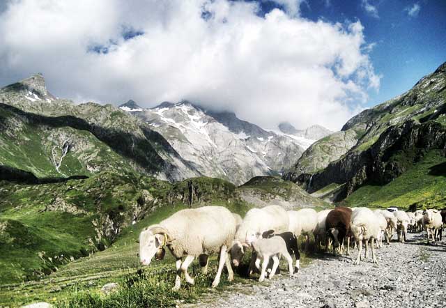
Photo by OT Vernet les Bains
- Area: Pyrénées-Orientales department in southern France
- Difficulty: Moderate to difficult
- Distance: 51miles (82 km)
- Elevation Gain:
- Days/Hours: 7 days
- Best Time to Go: Spring early summer or late summer to early fall
Route Description
The penultimate section of the GR10 takes you from Merens to Vernet les Bains. From Merens, the mountains open up giving you spectacular views.
This part of your journey lets you discover mountain villages, beautiful gorges and a natural reserve at Py and Mantet. Watch out for izards and wild mountain sheep as you hike.
Accommodation
From Merens you walk to the refuge of Besines.
Day two will then take you to the Lake of Bouillouses.
On day three you continue on to Planes, with this day takes you past the lake through forests.
From Planes, day four takes you to refuge of Ras de la Caranca.
From here you walk to the hamlet of Py.
From Py day six take you to Vernet les Bains, with day seven walking onwards from Vernet Les Bains.
Video Overview
Have a look at this video by Robert Gimenez of Vernet Les Bains trail completed in 2013.
8. Vernet les Bains to Banyuls

Photo by Duncan Roche
- Area: Pyrénées-Orientales department in southern France
- Difficulty: Moderate to difficult
- Distance: 80.7 miles (130 km)
- Days/Hours: 6 days
- Best Time to Go: Spring early summer or late summer to early fall
Route Description
On the final section of the GR10 you will see the environment change from Alpine to Mediterranean, with the sight of the sea and beach beckoning as you near the completion of your journey.
This last part you will journey from Vernet les Bains to Banyuls.
Accommodation
Day one of the final section takes you from Vernet les Bains to the refuge Marialles. Day two moves on to the Refuges des Cortalets.
From here you walk to Arles sur Tech and then day four takes you to Las Illas.
The next day you walk from Las Illas to the col de L’Ouillat, this day is a long one covering 21 km.
Day six journeys on to Banyuls, this day is also a long one but you are rewarded by the completion of this fantastic journey.
Video Overview
In this video overview of Vernet les Bains to Banyuls trail Franck Hidvegi summarises his entire hike.
Preparing for the GR10 Hike
When is the best time to trek GR10?
The best time to hike the GR10 is late summer to early fall, or from late spring to early to early summer. This way you avoid the summer heat and winter storms - in winter some of the GR10 is impassable due to snow.
However, if you stick to the end of the mountain ranges you will be able to walk all year around with any snow gear.
Are permits required for the GR10 hike?
You do not need a permit to hike the GR10 trail. It may be a good idea to book accommodation ahead of time, particularly in peak season.
How difficult are GR10 hikes?
The full GR10 is a challenging hike that takes between 45 to 60 days with hikers on average covering between 10 to 12 miles. While you don’t have to be an extreme mountaineer the hiking can be tough so it is a good idea to be fit before attempting the trail, especially if you plan on doing large chunks of it at once.
You will need to have some experience in walking in mountainous terrain as well as navigation in order to undertake this beautiful adventure. Luckily the trail is well marked by the red and white symbols the GR trails are well known for.
Is altitude sickness a risk on GR10?
GR10 hikes wind their way through some higher altitudes. It is always a good idea to be aware of your body and stay hydrated. However, generally altitude sickness is not a risk.
It is important to have a solid understanding of the risks associated with high altitude trekking and how the body acclimatises to high altitude. See our detailed article on Altitude Sickness and Acclimatisation.
What gear do I need for the GR10 trail? (Packing List)
This depends on how long you plan on hiking for and the time of year you are hiking. If you are attempting all 60 days in one go you will have to carefully consider your gear.
However, no matter if you join a tour group or hike the whole trail solo you can never go amiss with a good pair of hiking boots and good sun protection.
The harsher winter months may require snow gear, depending on where you are hiking.
For more packing lists see our Resources page, as well as detailed gear reviews.
What kind of insurance do I need for the GR10?
Hiking insurance is usually recommended for GR10 hikes. If an accident or incident should occur that requires immediate medical assistance and evacuation you will most definitely want adequate hiking insurance that can cover the costs of air ambulance and treatment.
Recommended GR10 Guidebook

If you are looking for an awesome book on the GR10 trail that guides you along your way, we recommend The GR10 Trail: Through the French Pyrenees.
The book includes step by step route descriptions as well as maps and gradient profiles.
A helpful guide, whether you plan on doing the whole GR10 hike or parts of the trail.
Regional GR10 Map

While free maps and information are easily available online, it is a good idea to take a map with along on the GR10 trail.
Although the trail is well marked with the GR symbols, nothing beats a physical copy for when you are feeling lost.
We recommend the Andorra (Pyrenees) 1:40,000 Hiking Map guides you along the many hiking routes in the Pyrenees.
Browse more hikes in Europe
See our top European hikes picks, or check out these popular hikes.

good morning, last year i did the GR65 in november & it was lovely and peacefull!………….do you know approximately how many people complete the pyrenees gr10 each year, is it ever 'busy'? best wishes
Hi Ian, congrats on completing the GR65. I’m not sure how many people complete the GR10 each year, but it’s not super busy (especially if you go during the shoulder months)