Iceland's Laugavegur trail is a renowned and popular trek that people come from near and far to experience.
The landscape along the trail is diverse and takes you on a surreal journey through the beautiful Icelandic wilderness. With multicolored rhyolite mountains, pristine glaciers, natural hot springs, black deserts and lush forest to see, the Laugavegur trail is a hiker's paradise.
If you're interested in taking on this incredible adventure, then have a look through this guide of everything you need to know about the Laugavegur trail before you plan your trip!
Quick Facts
- Elevation: 1,768 feet(539 meters)
- Highest point: 3,474 feet (1,059 meters)
- Difficulty: moderate - difficult
- Length: 34 miles (55 kilometers)
- Duration: 3 - 5 days
- No permit required
- High season is in July and August
Laugavegur Trail Overview
The Laugavegur Trail is located in Iceland's southern highlands and is a straight route from Landmannalauger to Þórsmörk, also known as Thórsmörk (Thor's wood).
It is typically done from north to south by starting at Landmannalauger, with its multicolored mountains, and ending in Þórsmörk, where the famous Eyjafjallajökull volcano is.
The route is 34 miles (55km) long and is generally completed in 4 days. There are also several quick walks you can do in the evenings from most accommodation points, which help to showcase more of Iceland's stark beauty and make your trip more worthwhile.
The huts and camps are open from late June until the end of August as these are the best months to take on the trek.
This is a moderate-to-difficult trek. As there are some steep areas and rivers that need to be waded through.
You can complete the trail with an average level of fitness but you should prepare yourself for some challenging sections and train your body for walking long distances in the time leading up to your trek.
Each day will require you to walk between 7.5 to 9 miles (12 - 15 km). The elevation varies from 130 - 1,608 feet (40 - 490 meters) each day with the highest point reaching 3,474 feet (1,059 meters) at Hrafntinnusker.
You'll begin the trek by travelling to Landmannalauger, which is located in Iceland's highlands and surrounded by striking, multi-colored rhyolite mountains.
From here you'll begin the long walk, passing through the Laugabraun lava field and ascending onto the Brennisteinsalda plateau, which offers breathtaking views of the colorful landscape.
You'll also pass the Stórihver hot spring, which will probably be the only patch of green you see on your first day. On the walk from Hrafntinnusker to Alftavan you will see numerous hot springs and ravines as you make your way up the Háskerðingur mountain for a view that shouldn't be missed!
As you descend the mountain, you'll enter into different terrain of dark palagonite and glistening glaciers until you reach Alftavan. You'll then travel past ancient volcanoes, through black desert land and flowing rivers into the lush farmland of Emstrur.
The last leg of the journey involves more river crossings and a descent into beautiful green land, which is a dramatic contrast to the dark deserts you pass through on the way.
Þórsmörk is a lush valley, filled with flourishing vegetation and flowers. Once you arrive here you should consider spending some more time exploring the scenic protected area.
Looking to do something after the Laugavegur trail? Check out this 3-day Iceland itinerary.
Please Note: There are many spots along the Laugavegur trail that require great caution as they are either very steep or require you to wade through water which can be very slippery. Be very careful as you step to avoid injuring yourself or spraining your ankles. It's recommended that you wade across the river hand-in-hand.
The weather along the trail can be very unpredictable so make sure to check the weather before you start walking each day. Also check whether it's safe with your guide or the hut warden.
Do not attempt to continue your walk if there have been warnings of bad weather, wait at the huts until it has cleared. Getting caught in a bad storm is very dangerous as the visibility will be poor and you can easily get lost.
Also be aware that you'll be sharing rooms with other travellers in the huts as they are built like dormitories with bunk beds and are unisex. So remember to pack earplugs if you struggle to sleep in a room with other people.
Laugavegur Trail Map & Guidebook

The Laugavegur Trail: A Hiking Companion to Iceland's Famous Trek is a detailed and easy-to-follow guide to Iceland's most famous and popular trail.
In this guide you will find all the logistical information you need, simple maps, and writer's stories, adding colour to your journey with some useful regional context.
Laugavegur Trail Itinerary

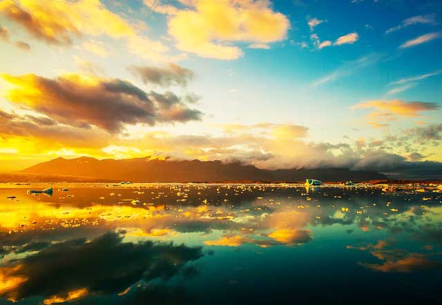
Photo by Neil
This itinerary follows the direction and route of the Laugavegur that is usually taken, however you can choose to start in Þórsmörk and end in Landmannalauger if that's what you prefer.
There are only a few huts to overnight in along the trail so no matter which direction you choose, you'll most likely still stay at the same places.
Landmannalauger to Hrafntinnusker (7.5miles/12km)
Hrafntinnusker to Alftavatn (7.5miles/12km)
Alftavatn to Emstrur (9.5miles/15km)
Emstrur to Þórsmörk (9.5miles/15km)
Video Overview
A beautiful video overview of Laugavegur trail in Iceland from Sawyer` Burnett. The clip (3:35 min long) was filmed in early September of 2017.
Laugavegur Trail Important Details
Best Time To Go
The Laugervegur Trail is only open from about mid-June to the end of August as that is when the weather is the best and the trail is safe to attempt.
This is the summer time in Iceland when weather conditions are most favorable.
The weather can be very unpredictable so the huts close down for the rest of the year and hiking the trail is not recommended. Most tour operators will only run their tours from July through to August.
Difficulty
The Laugavegur Trail is a moderate to difficult trek and can be done with an average level of fitness. It's recommended to train before your trip by going on more long-distance hikes or walks to help improve your endurance.
There are some steep parts of the trail which are more difficult so trek slowly and be careful. Keep in mind that there are also some rivers that you will need to wade through so prepare to get your feet wet!
You should not cross any rivers by yourself so if you're alone, it's advised that you wait for other hikers so you can go hand-in-hand through the water.
Safety
Extra tips for staying safe:
- Keep dry and warm to avoid hypothermia
- Leave your travel details online at Safetravel.is
- You should download the Icelandic Emergency App onto your phone
- List your name on the safety lists at the huts
- Do not cross rivers by yourself and walk across them hand-in-hand
- Pack a First Aid Kit
- Pack a compass, map or GPS in case you lose your way
- Stay hydrated!
- Check the weather before you set off for the day and listen to the wardens if they tell you it's not safe to continue
Laugavegur Trail FAQ
What gear/equipment do I need to bring?
What clothes should I pack?
Is drinking water available at the huts?
Will I be sharing a room with other travelers at the huts?
Is there Wi-Fi/ cellphone reception at the huts?
Browse more hikes in Europe
See our top European hikes picks, or check out these popular hikes.

